Saipal Base Camp Trek
Saipal Himal Base Camp Trek is a remote and less-trodden trekking route in the far-western region of Nepal. It leads to the base camp of Saipal Himal, which is known for its stunning natural beauty and the opportunity to explore off-the-beaten-path landscapes.
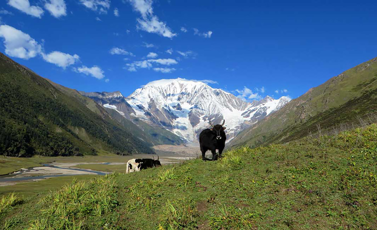
When observed from the east or north, Saipal is a magnificent peak. East Saipal Base Camp and North Saipal Base Camp can be reached from Simikot as a separate excursion or as an addition to the Limi Valley circuit. The road to the East Base camp departs Simikot to the south and deviates over steeply wooded terrain.
The region’s broad, rolling lekhs (pass) are forested with ancient blue pines, spruces, and gigantic cedars, and the villages nestled amid them are inhabited by Chhetris, Brahmins, Thakuris, and Bhotias, who are culturally and geographically separated from the rest of the country. Hindus and Buddhists engage in a level of cultural and economic engagement that is unrivaled anywhere in the Himalaya.
Mount Saipal is the second-highest peak in the far western region of Nepal. It measures an amazing 7031 meters in height. Whether viewed from the east or the north, this mountain is stunning. Simikot provides access to both the East and North Saipal Base camp. The East Base camp heads south from Simikot and deviates through a forested region with high slopes.
Saipal Himal Base Camp Trek Highlights
Saipal Himal Views: The trek offers panoramic views of the majestic Saipal Himal, which is one of the highest mountains in the region. The rugged and pristine beauty of this Himalayan range is captivating.
Remote Wilderness: The trek takes you through remote and untouched wilderness areas, allowing you to experience the raw and unspoiled natural landscapes of the far-western region.
Cultural Diversity: The trek passes through villages inhabited by different ethnic groups, such as the indigenous Raute and Raji communities. This provides opportunities to learn about their unique cultures and ways of life.
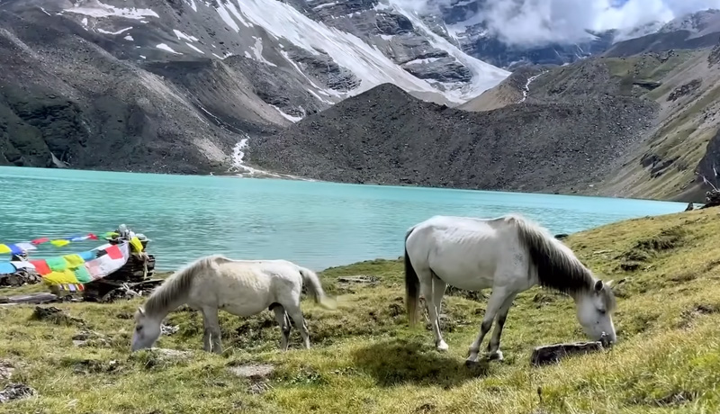
Rich Biodiversity: The region is rich in biodiversity, with various species of flora and fauna. You might spot some of Nepal’s rare wildlife, such as the red panda, Himalayan tahr, and various bird species.
Tribeni Confluence: The trek takes you to the confluence of three rivers: the Seti, Saipal, and Nampa. This natural junction of rivers adds to the scenic beauty of the trek.
Off-the-Beaten-Path: The Saipal Himal Base Camp Trek is less frequented by trekkers, offering a more tranquil and secluded trekking experience.
High Passes: The trek involves crossing high passes and traversing challenging terrains, adding an adventurous element to the journey.
Photography Opportunities: The pristine landscapes, towering mountains, and unique cultural encounters provide ample opportunities for capturing stunning photographs.
Camping Experience: The trek includes camping in remote locations, allowing you to immerse yourself in the wilderness and natural surroundings.
Authentic Exploration: The trek is ideal for adventurous trekkers who seek to explore regions that are relatively untouched by modern tourism.
The Best time for Saipal Himal Base Camp Trek
The best time for the Saipal Himal Base Camp Trek is during the pre-monsoon spring season (March to May) and the post-monsoon autumn season (September to November). These months offer the most favorable weather and trekking conditions for a successful and enjoyable trek. Both spring and autumn offer excellent trekking conditions, and your choice between the two depends on your preferences. Spring is known for its vibrant flora, lush landscapes, and blooming flowers, while autumn provides clear skies, pleasant temperatures, and excellent photography opportunities.
When you arrive at Tibhuvan International Airport, our guide will pick you up and take you to your hotel in the bustling Thamel district of Kathmandu. Depending on your arrival time, you can choose to relax for the next journey, see the city’s attractions, or shop for adventure gear in one of Kathmandu’s many adventure supply stores. We’ll assemble our bikes and be ready for the journey in the afternoon.
When observed from the east or north, Saipal is a magnificent peak. East Saipal Base Camp and North Saipal Base Camp can be reached from Simikot as a separate excursion or as an addition to the Limi Valley circuit. The road to the East Base camp departs Simikot to the south and deviates over steeply wooded terrain.
We will board an airplane on day three. We will fly from Kathmandu to Nepalgunj (55 minutes). After an exhausting day, you have the option of spending the evening in your hotel or exploring this vibrant city. It is a Submetropolitan City in Nepal’s Banke District. It is situated on the Terai plains near India’s Bahraich district’s southern border in Uttar Pradesh. It is a significant transport center renowned for the thrilling hikes to Simikot (the gateway to Mount Kailash and Manarowaor lake), Dolpo plateau, Rara, and the Jumla region. Nepalgunj’s climate is hot and humid, with an annual average temperature of 27.4 degrees Celsius and 1175 millimeters of precipitation.
This morning, following breakfast, we take the first flight to Simikot. Simikot is approximately a 45-minute flight to the north through the plains, going through the Siwalik Range and the town of Surkhet. There will be vistas of East Dhaulagiri and Churen Himal, with any luck. The optimal strategy is a delight. There are commercial banks, government and non-government offices, and schools in Simikot, which serves as the district’s administrative center. In this region, both Buddhism and Hinduism are practiced. The climate is generally mild, warm, and temperate. Summers are characterized by abundant precipitation, while winters are characterized by snow. Simikot has an average annual temperature of 10.5 °C and an average annual precipitation of 783 mm. After a light breakfast, make your way gently towards the Nyinba Valley. After around 1.5 hours of moderate ascent, you will find prayer flags and a tiny school. This location is known as Limbuk (3,227 m / 10,587 ft) Then, descend for another hour till Nyinba village. Bargaun (10,842 feet / 3,000 meters) is a Tibetan Buddhist settlement surrounded by barley and millet farms. Here, there are a few homestays. A homestay is a wonderful opportunity to interact with and learn about the local community in an open and genuine manner.
After a fantastic homestay in Bargaun. The trail descends towards the Karnali River. To reach Lali, we follow the old Sheep caravan road along the Karnali valley. It will take us on a sacred loop around some of Humla Karnali’s most remote regions. We descend through valleys with steep sides. The Karpunath Shrine is one of the day’s highlights. Yangchu is one of the principal villages of Khapunath Gaupalika, located on the Karnali River at the base of the Bigauda Danda mountain range. The majority of Thakuris and few Dalits (untouchables) adhere to Hinduism.
In the midst of a night with a rushing river, a hot beverage will revitalize you. After Brake, a quick journey will begin along the Humla Karnali River Valley to the south, passing through forests of Alnus, oaks, walnuts, Himalayan bamboo, pines, and juniper; Bokche Gauda is the next location of interest with a tea house allegedly available. The walk stays close to the river around the Bluff of Lali, where lunch is served, as we continue south. After traversing an undulating path to Biubare, the walk continues through an open area with tall pines. In Ripgard, the trek for the day comes to a halt.
As the trail turns west today, it becomes more difficult as it snakes through valleys in pristine woodland. The few communities are modest and have been rarely visited by outsiders. We will exit the Humla Karnali at the point where the river turns southeast. The road reaches Ogaliya by following the tiny river towards the Kheta Khola Valley. Continuing around the spurs, the trail reaches Bhuagdiya, where we will likely camp along the Khet khola wherever there is a level area.
Another day of hardship in the pine forest is interrupted by a glimpse of the riches to come. For the time being, the refers to the Dhid Lagna Pass, as the death of the valleys tends to obscure views of the peaks. The trail from Khet Khola to Dhid Lagna Pass ascends steeply ( estimate 3650 m). As the trail descends to Kawadi Khola, it is likely that the descent is also challenging. Now following the valley to the northwest, the path reaches Lampate.
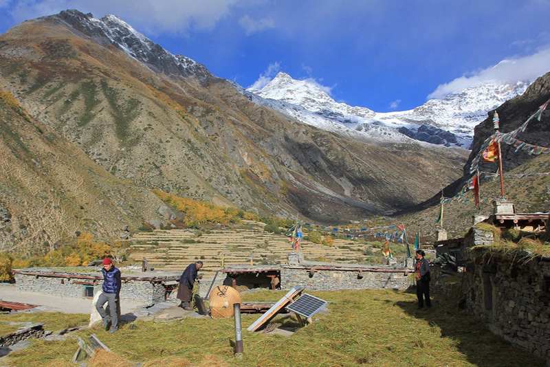
As the trail ascends the slopes, it leaves the pine forest below for the open pastries. The difficulty of reaching Rani Kharka depends on how far past Lamprate the last camp was established. The road towards Dhaule Kharka follows the valley. From this vantage point, there are expansive vistas; the camp is typically located at Rani Kharka, which offers a spectacular view of the enormous East face of Saipal.
The day can be as long or as short as desired, as the trail is same in both directions. Getting close to the enormous east face of Saipal is the primary objective, regardless of how far one hikes. The Nunekhara Glacier snout is the highest point that can be reached without climbing equipment. The presence of pines, juniper, himalayan rhododendron, and himalayan herbal bushes enhances the majesty of the vista. Himalayan Monals, Eagles, and Vultures are common inhabitants of the area.
It is unlikely that many individuals will wish to cross the Sakya Lagna on this day, given the distance to the camp on the north side is somewhat difficult. A leisurely day allows for more time to be spent in the valley before leaving Rani Kharkha. The path passes via Tharang Kharka, which is a rudimentary shelter. Heading north through the Lepcha Khola, the trail continues its ascent to a camp around or at the Lepcha Kharka Pass ( 4450m).
Sakya Lagna (4709m) is the route’s highest and most arduous pass. From the summit, though, the panoramic vistas are well worth the effort. Saipal. is the beacon of the southwest. The northern limit of the Tibetan plateaus is delineated by severe and endless craggy ridges. Khaniphuk Kharka descends precipitously to the confluence of the Karang Khola and Kalungba Khola. The flora and fauna of the Himalayas is another attraction of the region. From here, the trail heads west to the west to the north Saipal Base camp. Now, the pathways pass the Kalungba Khola and ascend to Chala ( 3750m). Chala resembles a traditional Tibetan hamlet.
In order to reach Yalbang, the track must ascend the Syakup pass (4214m), which is quite a distance from Chala. The trail descends quite steeply into the side valley of Puiya Khola, where a forest trail descends to the Humla Karnali Bridge near Muchu. A steady ascent to Yalbang ensues. There is a namkha khyung dzong monastery in Yalbang where monks can reside and pursue formal Buddhist education, including Math and English. The trail is the traditional caravan salt commerce route between Nepal and Tibet for sheep and goats. It contains an abundance of Himalayan flora and fauna.
The path descends to Yalbang chaur before ascending and dipping around the cliffs in the tight Karnali Canyon to reach the Salli Khola Valley. A short ascent leads to Salli Lagna, after which an eastbound road trail curves down and around to Kermi. If time permits, the hot spring could be a desirable choice. The trail is dominated by blue pine and also has Alnus, willow, and other species of Himalayan flora and fauna. Chukar is a commonly observed Himalayan monal.
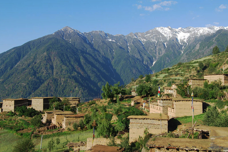
Kermi is a lovely Himalayan community where everyone is of Tibetan descent, practices Buddhism, and speaks their own language. The track currently follows the primary route between the Tibetan border and Simikot, following the Karnali river and the Valley, to reach the Valley. The day is straightforward with little obstacles. Passing via Dharapori (Community of Thakuris and minority of dalits (untouchables) adhering to Hinduism) is preferable to Dharapori similar to Dharapori. The region is covered with blue pines, juniper, alnus, and many apricot varieties.
A trek through Majgaun, a small Thakuri, Hindu, and Nepali-speaking village. The trail leading to the final ascent to Simikor Lagna is somewhat arduous, but it is a suitable hike for the final day. The short slope on the gravel trail leads back to Simikot’s pleasures. The trail is primarily composed of blue pine and protected community woodland containing juniper and pipal. The trails are scented with the aroma of Pine. Once the Simikot Lagna has been conquered, a magnificent view of the Simikot plateau and the Humla settlement may be observed from the Simikot Lagna.
It is possible to experience a mixture of cultural, traditional, and religious practices at Hotel Simikot, the district headquarters. When the weather is favorable, we take the first flight to Nepalgunj, connecting on the same day to Kathmandu. We arrive in Kathmandu in the afternoon.
Today we will take you to the airport to catch your flight out of Nepal. Alternatively, if you’d like to stay longer, we may make additional travel arrangements to assist you continue your cycling experience.
- All necessary ground transfers.
- All necessary accommodations as per the itinerary.
- Tea House accommodations during the trek.
- Daily breakfast, lunch and dinner during the trekking.
- All necessary paper works.
- All necessary tre
- kking permits.
- Experienced and First Aid-trained trekking guide.
- Strong, helpful porters.
- Comprehensive medical supplies.
- Trekking map.
- Insurance of all local team.
- Warm clothing and trekking gear for staff.
- Sleeping bag and trip duffle bag.
- Trekking certificate issued by us.
- Welcome and farewell dinner in Kathmandu.
- Nepal Visa fee.
- International flights.
- All meals not mentioned in inclusions.
- Personal expenses not stipulated.
- Optional add-ons.
- Gratuities.
Price Per person starting from
US$ 2200
| Get Instant Response 9779851038908 (Whatsapp) |
Inquiry this trip
You might also like...
Top Add-on Trips
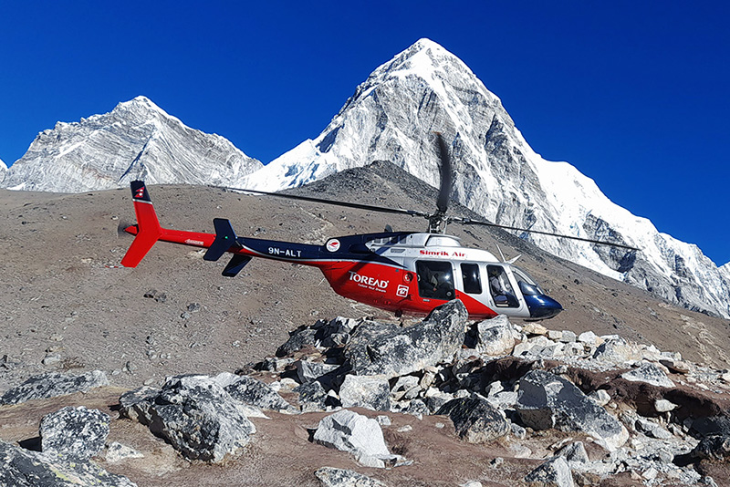
Everest Base Camp Helicopter Tour
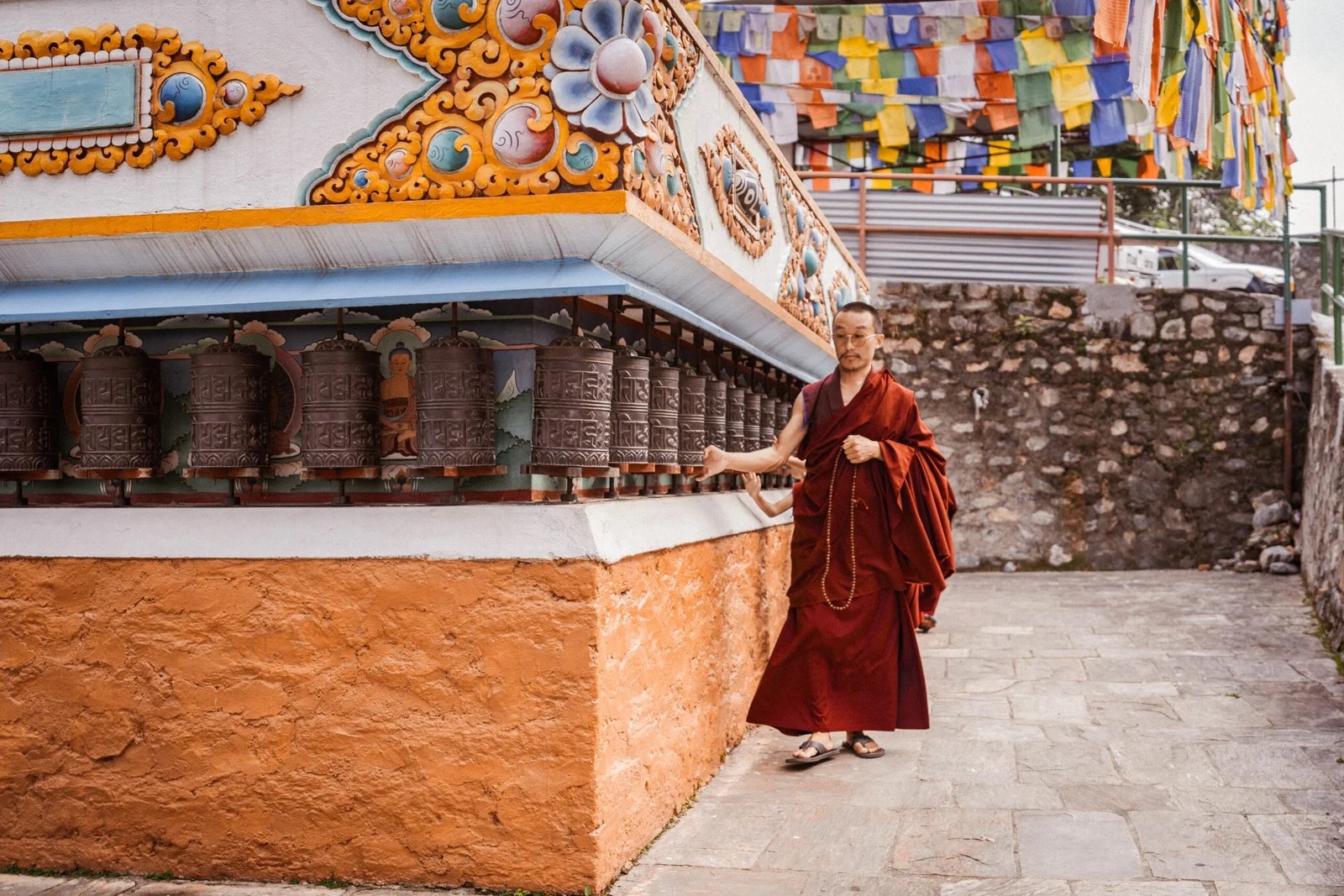
Monastery Stay Tour