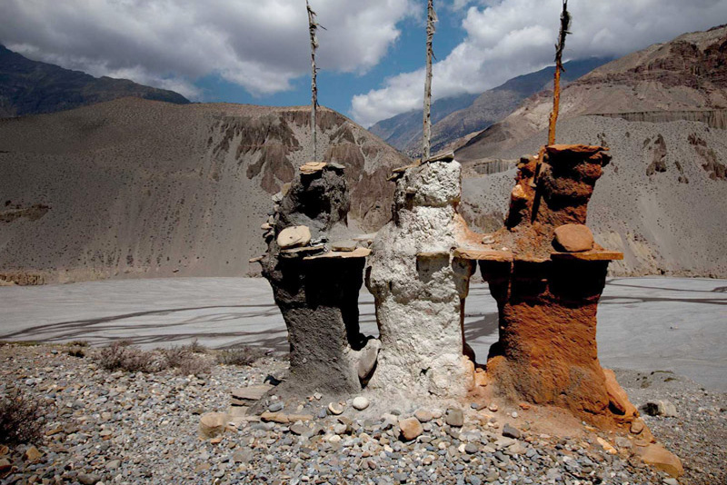
Dolpo Circuit Trek
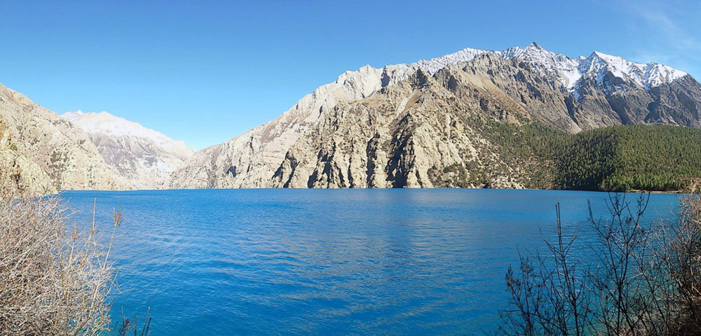
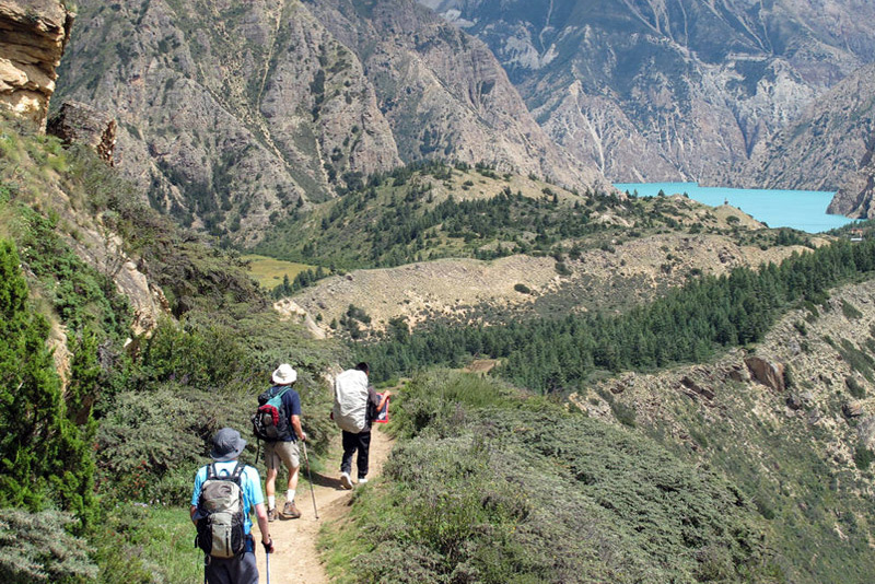
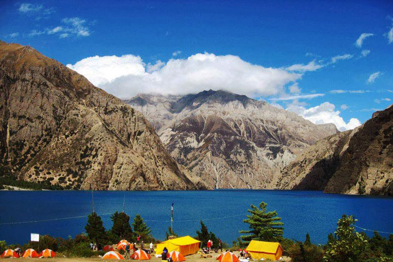
Dolpo Circuit Trek offers a unique opportunity to explore the culturally rich and stunningly beautiful landscapes of the Himalayas. We traverse a variety of settings, from green pastures reminiscent of the European Alps to rocky terrain reminiscent of the Tibetan plateau. The Phoksundo Lake is of remarkable beauty, with its deep blue and green hues and its rugged, precipitous surroundings.
Small Tibetan settlements inhabited by Tibetans’ direct descendants are passed by. Buddhism and Bonpo are vital to the inhabitants of these communities and are interwoven into daily life. Tibet’s oldest spiritual tradition is Bonpo religion. Dolpa is closely associated with Buddhism, yet its shamanistic and animistic influences lend it a legendary quality.
Due to its distant position, Dolpa is still a “destination off the beaten path.” Particularly in the spring and summer, we hardly encounter other travelers. The Dolpa Circuit is a challenging hike with several high ascents. We must traverse two passes, Numa La at 5318 meters and Baga La at 5118 meters. This traverse comprises lengthy ascents and descents. But the landscape along the way, the views from the passes, and our interactions with the Dolpa will make the journey worthwhile.
Dolpo Circuit Trek Highlights
Trekking to the Dolpa Circuit is an unforgettable experience. This trek is a remote and challenging trekking route located in the Dolpo region of Nepal affords us the chance to explore living in the isolated highlands. Here are some highlights of the Dolpo Circuit Trek.
Remote and Untouched Landscapes: Dolpo is one of the most remote and least developed regions in Nepal. The landscapes are untouched by modernization, offering trekkers a rare chance to experience traditional Tibetan culture and lifestyle.
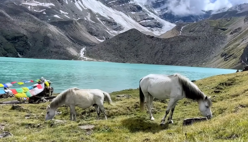
Shey Phoksundo Lake: One of the main attractions of the trek is Shey Phoksundo Lake, a pristine turquoise-colored lake surrounded by rugged mountains and unique rock formations. It’s the deepest lake in Nepal and holds religious significance for the locals.
Shey Gompa: This ancient monastery is situated near Shey Phoksundo Lake and is a major pilgrimage site for Buddhists. The monastery’s architecture, intricate paintings, and spiritual atmosphere make it a fascinating cultural stop.
Phoksundo Waterfall: As you trek through the beautiful landscapes, you’ll come across the stunning Phoksundo Waterfall, which cascades dramatically down a cliff face.
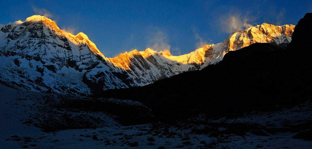
Trans-Himalayan Scenery: The trek takes you through a variety of landscapes, including dense forests, barren landscapes, high mountain passes, and picturesque valleys. The views of the snow-capped peaks and the stark beauty of the terrain are truly captivating.
Unique Culture: The Dolpo region is culturally distinct, with its Tibetan Buddhist heritage and Bon practices. You’ll have the chance to interact with the local Dolpo people and learn about their ancient customs, traditions, and way of life.
Challenging Passes: The Dolpo Circuit Trek involves crossing challenging high passes, including the Kang La Pass and the Numa La Pass. These passes offer stunning panoramic views of the surrounding mountains but require good physical fitness and acclimatization.
Wildlife: Dolpo is home to various rare and endangered wildlife species, including the elusive snow leopard, blue sheep, and Himalayan tahr. Keep an eye out for these magnificent creatures during your trek.
Limited Tourist Footprint: The Dolpo region has limited infrastructure for tourism, ensuring that the area remains relatively untouched by mass tourism. This adds to the sense of adventure and exploration.
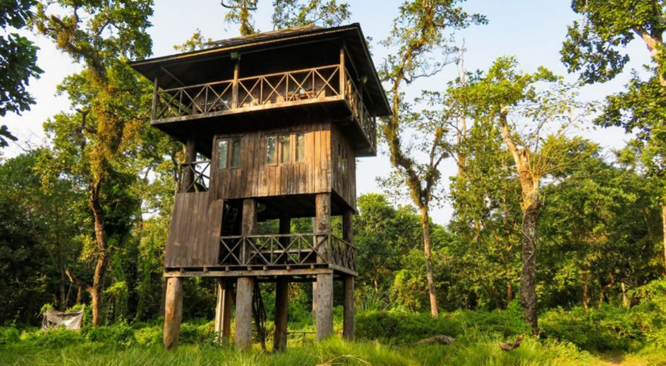
Camping Experience: Given the remoteness of the area, the trek involves camping in pristine wilderness areas. Camping under the starlit Himalayan sky adds to the magical experience of the journey.
The Best time for Dolpo Circuit Trek
The best time for the Dolpo Circuit Trek is during the autumn (September to November) and spring (March to May) seasons. These months offer the most favorable weather and trekking conditions for a safe and enjoyable experience. Here’s why these seasons are recommended.
Autumn (September to November):
Stable Weather: Autumn is widely considered the best trekking season in Nepal, including the Dolpo region. The weather is generally stable, with clear skies, minimal rainfall, and pleasant temperatures during the day.
Excellent Visibility: The clear skies provide exceptional visibility, allowing trekkers to enjoy panoramic views of the surrounding landscapes and snow-capped peaks.
Vibrant Landscapes: The landscapes are lush and green after the monsoon season, creating a beautiful contrast with the rugged terrain. This adds to the overall visual appeal of the trek.
Spring (March to May):
Mild Temperatures: Spring brings mild temperatures, making it comfortable for trekking during the day and warmer at lower altitudes. It’s a great time to experience the outdoors without extreme cold.
Blooming Flora: The rhododendron forests and other vegetation come to life with vibrant blooms, creating a colorful and picturesque backdrop for your trek.
Clear Views: Similar to autumn, spring offers clear skies and excellent visibility, which is ideal for capturing stunning photographs and enjoying breathtaking mountain views.
Both of these seasons offer a unique and rewarding experience on the Dolpo Circuit Trek. However, keep in mind that due to the high altitudes and challenging terrain of the Dolpo region, it’s important to be well-prepared for the trek. Acclimatization, proper gear, and a good level of physical fitness are crucial to ensure your safety and enjoyment.
When you arrive at Tibhuvan International Airport, our guide will pick you up and take you to your hotel in the bustling Thamel district of Kathmandu. Depending on your arrival time, you can choose to relax for the next journey, see the city’s attractions, or shop for adventure gear in one of Kathmandu’s many adventure supply stores. We’ll assemble our bikes and be ready for the journey in the afternoon.
After breakfast process for the UNISCO Heritage Sightseeing tour. Visit Swyambhunath Temple, Kathmandu Durbar Square, Patan city, Khokana Village and after sight-seeing tour, transfer you back to hotel. Overnight Kathmandu.
Today, we will fly from Kathmandu to Nepalgunj (60 minutes). After an exhausting day, you have the option of spending the evening at your hotel or exploring Nepalgunj. It is a bustling city that warrants exploration. This will also help you unwind before the hike.
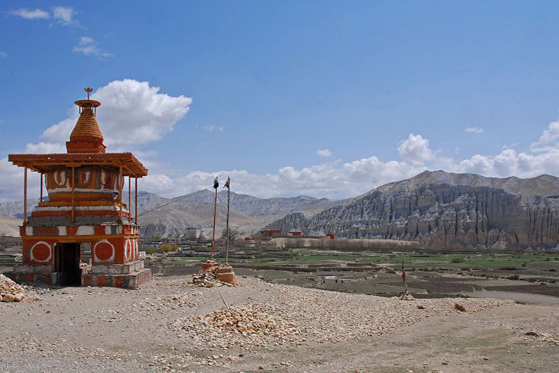
It is only a 35-minute flight over rugged mountain ranges and snow-capped mountains to reach Juphal. From Juphal, we descend a tiny route through wheat and vegetable-filled fields to the Thuli Bheri River, which we shall reach after reaching this point. We pass a lovely gate chortens (stupa) around 45 minutes before to Dunai, which is the entry of the VDC (Village Development Committee) Dunai, where we can witness the wonderful Buddhist paintings of mandalas and prominent Buddhist characters.
Dolpa District is headquartered in Dunai. It is situated on the opposite bank of the river, on a slope overlooking Dunai. The Dolpo Bon School and Hostels are located a short distance from Dunai on the same hill. The Bon School educates pupils in the Bonpo faith, Tibetan culture, and Tibetan language. We spend the night in a tent camp.
As soon as we leave Dunai, we enter a breathtaking mountainous terrain that sometimes resembles the European Alps. Pine trees, primarily blue pine, are scattered throughout rocky slopes. We can see the snow-capped Kang Tokal on the horizon (6294 m). Following the Thuli Bheri River, the trail slopes somewhat up and down. We pass the Buddhist settlement of Byasgar (2427 m). The inhabitants of this region are Taralis, a Magar tribe.After Byasgar, the terrain becomes increasingly rugged and rocky. The path is occasionally dug out of the rocks, and in a few places it is extremely narrow. We reach Lingdo, a little settlement where we spend the night in a tent camp, after traversing a large and difficult terrain.
The road progressively ascends. Along the trip, we have an excellent perspective of several of the settlements in this region, such as Sarankot, which is perched on a cliff. These are the final settlements we would encounter before reaching Dho Tarap. Some Mani walls and chortens are passed by. The terrain is sometimes lush and magnificent. There are junipers and various types of pine trees growing on sharp rocks. The trail ascends steeply up a slope and travels high above the Thuli Bheri River, leading to a 120-meter-long suspension bridge also high above the river. We arrived in Laisicap (2772 m). On the opposite bank of the bridge After Laisicap, Laina Odar is around three hours of arduous climbing (3370 m). The trail passes through woodlands, and we are flanked by steep pine-covered cliffs, some of which are enormous. Close to Laina Odar, the trail follows the river once more. We spend the night in a tent camp.
The trail ascends to a small pass, which requires around 45 minutes of climbing to reach. After the pass, the trail is very flat with a few minor ascents. It is occasionally a lovely stroll through pine forests, which have a nice aroma. Approximately four hours after departing Laina Odar, we arrive at Nawarpani (3475 m), where we spend the night in a tent camp.
The trail traverses a dry or more desolate area, going past a river valley with towering cliffs on both sides. In this arid environment, the blue sheep resides. If we are vigilant, we have a good chance of spotting large crowds up on the mountains. It is an easy hike that gradually ascends. Several portions of the walkway are intricately carved out of the rock. The trail ascends sharply for around half an hour to a tiny pass with an attractive chorten (stupa). From the pass, Sisaul is 30 minutes away (3750 m). We spend the night in a tent camp.
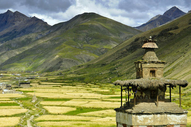
The trail climbs to another small pass. Shortly after the pass, the valley suddenly widens. The trail stays besides the river. At the horizon a small collection of houses is appearing in between the mountains: Dho Tarap. Getting nearer to Dho Tarap, we cross many Mani walls and small chortens.A Dho Tarap is a traditional agricultural village, surrounded by fields. Yaks are used to plough the land. Barley, buckwheat and potatoes are among the few crops that can grow in this barren landscapeThe houses are made of stones found in the river valley and are in typical Tibetan style, with small windows and the flat roofs stocked with firewood.
Close to Dho are 2 monasteries which are worth a visit. Ribo Bhumpa Gompa, Gompa belongs to Nyingmapa Buddhism right on the hill behind Dho, and Shipchaur Gompa, which is in the village Shipchowk, 30 minutes walking from Dho. Shipchaur Gompa in Shipchowk belongs to Bonpo Buddhism. We stay overnight at tented camp.
As it is only a 3 ½ hours walk to Numala Base Camp, we pass a beautiful gate chorten. After more or less half an hour, we arrive at the Crystal Mountain School which is sponsored by a French NGO and worth to visit. From the school, it’s about half an hour to Tokyu (4209 m), a spread out village, which is said to be the highest permanent settlement in the world. The Gompa is at the end of the village, and is worth a visit. It has a beautiful statue of Maitreya, the Future Buddha. From the Gompa, it is a gradual climb of about 1 ½ hours over grassy land to Numala Base Camp (4440 m). We stay overnight at tented camp.
Early morning trek to Numa la pass give us the spectacular view of the mountain ranges from the pass. It’s a long and strenuous climb of about 3 hours to Numa La (la means pass) at 5318 m. The altitude makes we go slowly and we get out of breath quickly. We have a stunning view from the pass on countless snowcapped mountains. Dhaulagiri (8167 m) , Annapurna and Manaslu Range, the Shey Shikar (6139 m), Kanjirowa (6883 m) and many, many others. In spring there can be snow on the pass, which makes the crossing a bit harder. After the pass we go down steeply for about an hour. Then the path becomes pretty level and later climbs slowly but steadily again for about an hour. It’s an amazing spot close to the river (Panklanga Khola). To the south the beautiful snowcapped Norbung Kang (6085 m) is towering high above the campsite. On the other side of the river there are high pastures, which are often used by yaks to graze. We stay overnight at tented camp.
An early start is best. The path continues on the slope on the other side of the Panklanga Khola and climbs pretty steep, going “zig zag” over the slope. Soon we are high above the river. A good 2 hours after leaving camp we reach the high camp, which is already close to the pass. From here we have an excellent view on the Norbung Kang and the Baga La range Baga La (5190 m). From the pass we have a splendid view on many snowcapped mountains like Kanjirowa and Shey Shikar. After the pass, the path descends pretty steep at the beginning. This part can be icy which makes it slippery, we walk in stunning scenery of huge rocks in all kind of colors with at the Horizon Mountains covered with snow. And then, suddenly, more or less 1 ½ hour after leaving the pass, we will see green bushes and a bit later even tree Besides, we will see a couple of beautiful waterfalls along the way. It’s rather flat and easy walking, very gradually going down, till we reach Yak Kharka (3982 m), another beautiful place to camp. We have a great view of the imposing Kanjirowa Himal (6612 m). Besides, in spring the meadows are full with flowers.
The path is going up and down and stays level sometimes. The path is beautifully carved out of the rocks and leads to a small pass. After the pass, the path goes into a pine forest. Leaving the forest, we cross a small bridge from which we climb in a couple of minutes to Ringmo.
Ringmo is a charming village. Ringmo lies at the shore of the holy Phoksundo Lake. This lake is of an incomparable beauty. It has an enchanting deep blue color and is emerald green close to the shore .If we want; we can walk a part of the famous Demons Trail from the movie Himalaya (Caravan) of Eric Valli. This is a beautiful movie about the life of people in Dolpa, At the other shore, there is a beautiful Bonpo Monastery which we can visit. In the monastery we can observe a statue of Tonpa Shenrab Miwo, the founder of Bonpo religion, who lived thousands of years ago.
Phoksundo Lake is part of the Shey Phoksundo National Park. It’s Nepal’s largest National Park, established in 1984, with an area of 3,555 km². It aims to conserve the Trans-Himalayan ecosystem and the Tibetan type of flora and fauna. we can camp at the shores of Phoksundo Lake.
Walking time to Rechi is about 4 hours and from Rechi to Chhepka is 3 ½ hours as well.The path is rather flat at first, but soon climbs steeply up the hill. The walk to Rechi goes almost entirely through beautiful pine forests, with some bushes, birches and other broad leaved trees mixed in. Soon after the top we’ll come across Nepal’s highest waterfall, a spectacular waterfall of 167 meters high, the Phoksundo Waterfall. More or less one hour after the viewpoint we reach the Amchi Hospital. It’s about 1 ½ hour more to Rechi (2940 m). We walk through the forest, with birds singing. The river flows rapidly and is beautiful emerald green at some places. The village Rechi is at the other side of the river. It’s a very small village and consists of just a couple of houses and a primary school.
The trail stays Nepali flat to Chhepka, following the river all the time. We notice that we are descending; not only by the increasing temperature, but also by the difference in vegetation. After about 3 to 3 ½ hours we reach Chhepka, a small village, surrounded by fields of millet and wheat.
Descending with some small climbs. We can see a part of the Dhaulagiri range. We pass villages like Sangta (2520 m) and Kageni (2413 m) and reach the checkpost of the Shey Phoksundo National Park (SPNP) again. After crossing a big iron suspension bridge (the Dhim Bridge, 99 m long) we go left (west) to Juphal .From the bridge, it’s about 2½ – 3 hours to Juphal. The first part goes over a large path, passing through the small village of Kalagaonda. It’s a pretty steep climb to reach Juphal. Just before arriving, we pass the Hindu village Dangiwada. Juphal is a large village with a small bazaar where it is nice to spend some time looking around.we stay overnight at local guest house.
Early in the morning we fly to Nepalgunj. Especially the first part of the flight through the mountain valleys is spectacular. Later in the day, we fly back to Kathmandu. Spend the leisure time in Kathmandu on your own shopping or short sightseeing around city.
Breakfast in the hotel and today you have a free day in Kathmandu for your own activities and relax little bit before your long flight back to home. Today you can go for shopping, maybe massage to relax your body or short visit to Kathmandu Durbar Square which is in walking distance from Thamel. Overnight in Kathmandu.
Breakfast in the hotel and you have free time for your own activities. Afternoon one of our representatives will transfer to airport for flight onwards on your destination.
- All necessary ground transfers.
- All necessary accommodations as per the itinerary.
- Tea House accommodations during the trek.
- Daily breakfast, lunch and dinner during the trekking.
- All necessary paper works.
- All necessary trekking permits.
- Experienced and First Aid-trained trekking guide.
- Strong, helpful porters.
- Comprehensive medical supplies.
- Trekking map.
- Insurance of all local team.
- Warm clothing and trekking gear for staff.
- Sleeping bag and trip duffle bag.
- Trekking certificate issued by us.
- Welcome and farewell dinner in Kathmandu.
- Nepal Visa fee.
- International flights.
- All meals not mentioned in inclusions.
- Personal expenses not stipulated.
- Optional add-ons.
- Gratuities.
You might also like...
Top Add-on Trips
Everest Base Camp Helicopter Tour
Monastery Stay Tour
