Upper Dolpo Trekking
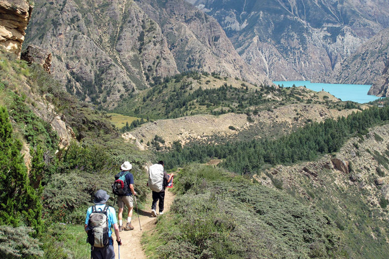
Upper Dolpo Trekking is one of the remotest treks in the Himalayas of Nepal, located on the western corner of the country and Dolpo is a camping trek.
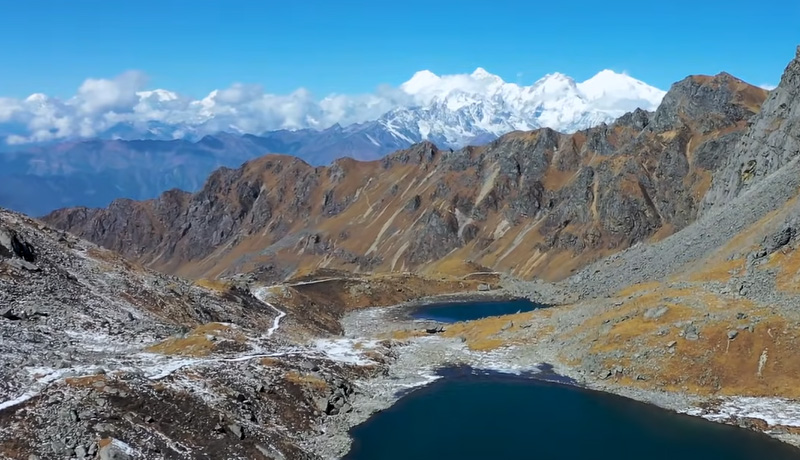
The Dolpo region, nestled between the high Tibetan plateau and the Dhaulagiri region, is the Shangri-la of your fantasies. The majority of the terrain is undiscovered and undeveloped, making it ideal for hikers who wish to escape the crowded main trekking routes.
Upper Dolpo Trek is an experience of a lifetime. Trekking to the distant and secluded part of the central-western region of Nepal and observing the scenery in its naturally harsh state and isolation can help you to comprehend.
At Dolpo, you will encounter Bon Pot, an ancient Pre-Buddhist religion and culture far removed from your hectic home life. With a bit of luck, you may encounter unusual species such as Blue Sheep, Snow Leopards, Mountain Goats, and Himalayan Langurs on the Trek.
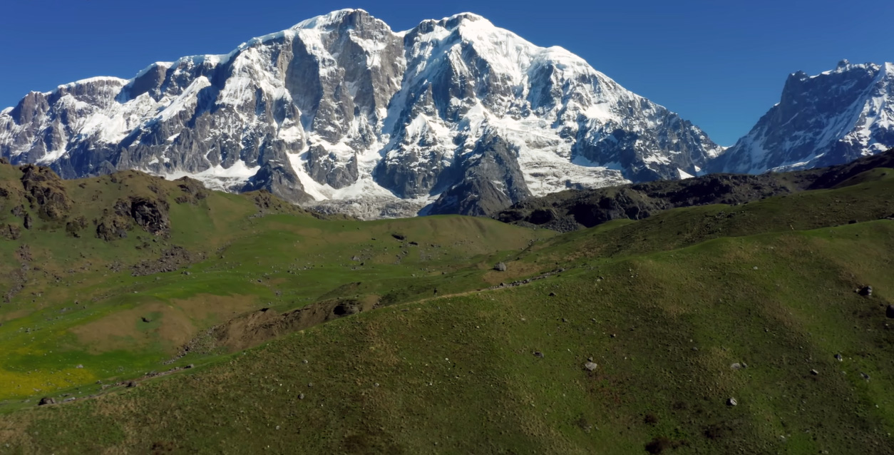
Dhaulagiri (8167m) and Chure Himal ranges border the east and south skylines, respectively. Dhaulagiri was once believed to be the tallest peak in the world! From upper Dolpa, the view of Dhaulagiri, Annapurna, and Kanjiroba is truly royal.
Before 1989, the entire district was off-limits to trekkers. This has made this location one of the most ancient and well-preserved in the world. Few anthropologists and geographers explored the region in the past. Explore the Upper Dolpo and get off the main path!
Upper Dolpo Trek Highlights
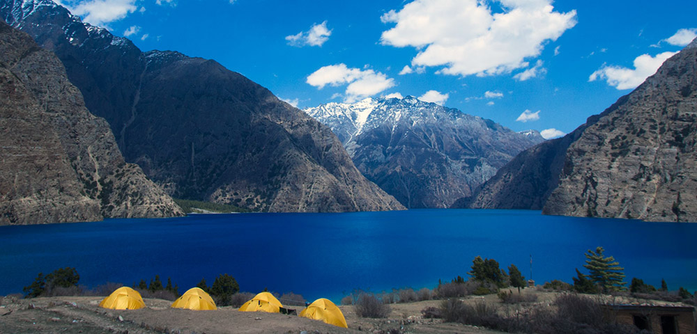
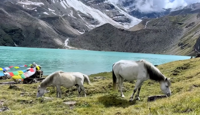
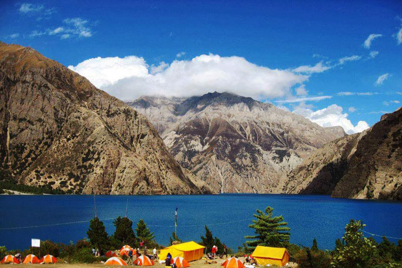
Discover the enchanting beauty of Shey Phoksundo Lake, renowned for its pristine, crystal-clear waters and stunning turquoise hue. Experience a one-of-a-kind camping adventure amidst the diverse landscapes of the area, uncovering its hidden treasures along the way.
Buddhist holy places are significant locations within the Buddhist tradition. Crystal Mountain and Shey Gompa are two places that are known for their unique Bon Buddhist culture. Experience breathtaking mountain views as you traverse high passes over 5000 meters. Immerse yourself in the local culture by meeting friendly locals and explore ancient monasteries along the way.
I recommend visiting the medieval village of Saldang and the nomad camps at Dho Tarap, which is known as the highest human settlement in the world. Discover a wide range of plant and animal species in the captivating Shey Phoksundo National Park.
The Best time for Upper Dolpo Trek
The best time for the Upper Dolpo Trek is during the post-monsoon autumn season (September to November). This period offers the most favorable weather and trekking conditions for a successful and enjoyable trek. The Upper Dolpo Trek is a remote and challenging trekking route, and trekking with a guide or through a reputable trekking agency is highly recommended for safety, cultural understanding, and logistical support. The Dolpo region has a unique cultural and natural environment, so it’s important to approach the trek with respect for local customs and traditions.
When you arrive at Tibhuvan International Airport, our guide will pick you up and take you to your hotel in the bustling Thamel district of Kathmandu. Depending on your arrival time, you can choose to relax for the next journey, see the city’s attractions, or shop for adventure gear in one of Kathmandu’s many adventure supply stores. We’ll assemble our bikes and be ready for the journey in the afternoon.
We’ll start the day early and drink some coffee from the Himalayas before beginning the six-hour drive to Besisahar. We’ll get to visit Nepal’s stunning countryside away from bustling Kathmandu. There will be time to take in the scenery and have lunch as you go through its numerous lush, terraced farms. We will meet our local porters for the journey once we arrive in Besisahar and start getting ready for the ride the following day. The first of many teahouses on the journey will be where we have our first welcome dinner and spend the night.
Today, we will fly from Kathmandu to Nepalgunj (60 minutes). After an exhausting day, you have the option of spending the evening at your hotel or exploring Nepalgunj. It is a bustling city that warrants exploration. This will also help you unwind before the hike.
We will take another tiny plane from Nepalgunj to Juphal. Our flight will last approximately 35 minutes. After touching down in Juphal, we will meet up with our hiking crew and travel through the verdant terraced farms along the Bheri River and the narrow canyon. We will reach the settlement of Dunai after a three-hour journey. We shall spend the night here.
Before moving west from Dunai, we shall cross a suspension bridge. At the confluence of the Thuri Bheri and Suli Gad rivers, we will follow the Suli Gad northward. In the backdrop, we shall journey gradually with the sound of the river prospering. We will through fields of hemp, millet, pumpkin, and potatoes. We shall continue our journey along the river until we reach the Hanke village. It serves as the entrance to Shey Phoksundo National Park. To reach Ankhe, we shall traverse Parela and Rahagaon on foot. Fascinatingly, Parela means eyelashes, Rahagaon means eyebrows, and Ankhe signifies eyeballs.
Today, the walk becomes a little more difficult. After crossing a diminishing river via well-constructed bridges, we will ascend a narrow, steep trail. From there, we shall descend down the river for some time before ascending once more. We will appreciate the breathtaking panorama of the surrounding landscape. We may camp along the Suligad River bank.
We shall begin our day at an early hour. The first few hours of the walk will be rather uncomplicated. From Sumdo, we’ll plummet precipitously. We will ascend a peak at 3,875 meters from which we will have an amazing view of the 300-meter waterfall. This waterfall is the largest in Nepal. We are also able to view Phoksundo Lake. We will descend through gorgeous Birch trees to reach the Phoksundo Khola and the picturesque village of Ringmo, which is adorned with Chortens and Mani walls made of mud plaster. It is a dynamic and active village. From here, we will go a short way to reach the Phoksundo Lake shoreline. The lake will serve as the backdrop for our overnight camp.
We will follow the exciting trail that is hung on a wooden boardwalk supported by pegs driven into rock crevices. We will ascend steeply to 4,040 meters, then descend to the valley floor to reach the Shey Phoksundo Khola riverbank. Here we will spend the night camping.
We will cross a couple creeks barefoot today! We will traverse the glacial valley and continue northward. As the trail continues to narrow, we will traverse spectacular vertical cliffs and twisted rock formations. At the confluence of the Phoksundo river and another unidentified river, we discover an antique wooden bridge. A long, arduous ascent will lead us to a sheep-grazing area from where the trail will ascend a quiet gorge. Then, another arduous ascent to the summit awaits. It will lead us to a different valley from which we will be able to observe the perilous Kang La Pass. Even before we arrive, we set up camp.
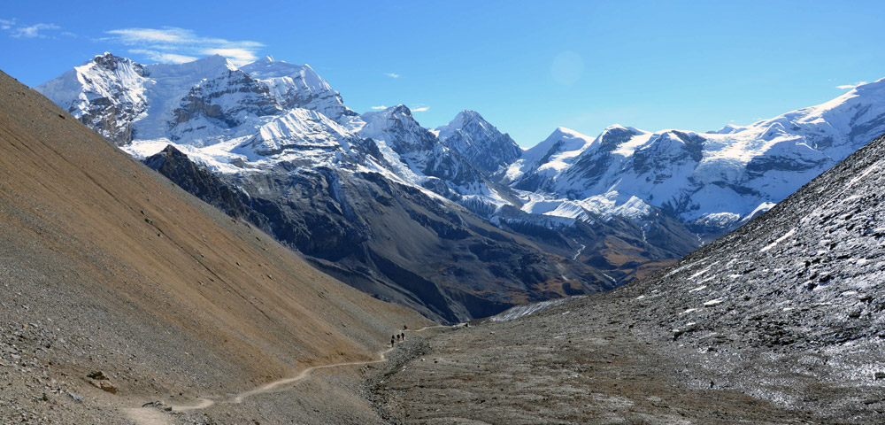
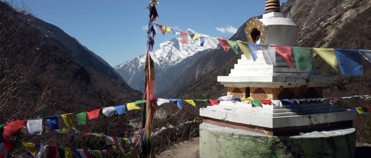
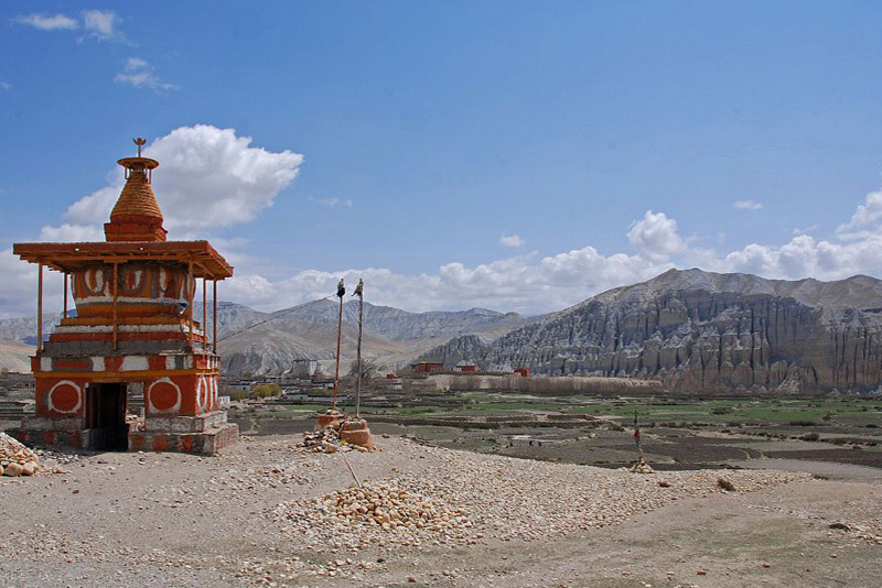
Today will be arduous. It will take us approximately three hours to reach the summit of the 5151-meter-high Kang La Pass. The vista from the summit will be worth all the effort. While descending, greater caution is required. A stunning red Chorten will commemorate your entrance at Shey Gompa. We will spend the night in a tent in the Shey Gompa compound, which will be reached over an old-fashioned wood bridge.
Shey translates literally to crystal in Tibetan. This monastic complex is also known as Crystal Mountain. We may visit the Shey Gompa and receive the Lama’s blessings. West of Shey, we can also visit the Tsakang Gompa. During the Middle Ages, this was a center for meditation for lamas. The monastery was constructed in the eleventh century. Here, Tibetan Buddhism and the ancient pre-Buddhist faith Bon Po are harmoniously combined. We can subsequently tour the area and its surroundings.
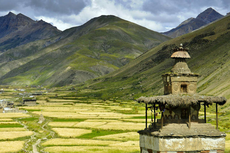
We will begin the day by hiking along a trail lined with juniper bushes. We shall ascend a gloomy, stony canyon. It begins with a meandering trail of boulders and degraded dirt and will lead us to a picnic-friendly level area. After twenty minutes of tough ascent, we will reach the summit of Saldand La Pass. From this vantage point, we can appreciate the magnificent view of Mustang’s arid, copper-colored environment. Then, we’ll descend the northern slope. The sight of grazing yaks and nomadic tents fashioned from yak hair will be warm and inviting. This signifies your entry into the Namduna Gaon. Here, we can see the Namgung Monastery, which is situated against a cliff. The village consists of only six homes and two sides of terraced fields. We can observe expansive Barley fields, the primary crop of the region. We are able to visit the nearby monastery.
We will ascend as we leave the Namjung Valley. We begin with a lengthy and exhilarating mountain crossing. At the bottom of the valley, terraced fields of ripening crops are visible. We will ascend for some distance before descending to the picturesque settlement of Salding. Salding is situated high above the Nam Khong Nala River on a plateau. It is the largest community in the district.
We will depart Saldang in the early hours of the morning and travel along the riverbank and terraced fields until we reach the stupas and Chortens. On the way, we can observe numerous Mani stones and visit the Chaiba Monastery. We will travel through Namdo, a flourishing village with sixty dwellings and four hundred inhabitants. We can visit the Namdo monastery and observe an additional monastery on the cliff’s edge. Along the riverbank, we will camp close to the community called Sibu. A wonderful camping site.
Following the diminishing river, the first few hours of the hike will be very straightforward. Two hours later, we will cross a second creek before turning into a side valley. The ascent from there is really steep. We will eventually approach a nice, rock-strewn meadow.
The trail is currently compacted, making trekking easier. Occasionally, however, it becomes quite steep. Two hours are required to reach the summit of Jeng La. The view of the Dhaulagiri Massif from this location is simply stunning. After a difficult descent towards the Tarap Valley, we will arrive at a verdant valley. The valley that opens before us, Tarap Chu, is simply lovely. Along the Tarap Chu, its broad plains surrounded by snowy mountains extend for 20 kilometers. When we reach Tokyu Gaon, we will be able to tour Gompas and Chortens. We can spend the night within the grounds of the Tokyu Monastery. The monastery is affiliated with the Chaiba sect.
Today’s trail is wide and fairly simple. We will through farms where men and women will be busy gathering crops. We can also observe Mani Walls and Chortens, many of which are in need of repair. Tarap is primarily occupied by Magars, with a small Tibetan population. People in this area practice either Bon Po or Buddhism. Here, we can visit the Gompa and be blessed by the resident Lama. We shall once again spend the night in a camp.
Following the Tarap Khola route, we shall descend. On our way, we shall traverse some narrow canyons. Here we may encounter blue sheep, yaks, and people grazing their yaks and goats. As we climb away from the river, the path will become more undulating. We shall traverse a contemporary suspension bridge. The trail can become quite tight at times. We will spend the night in a campground.
We will continue our descent down the Tarap River canyon. We will hike on a variety of trails today. From wide and simple to rather narrow and steep. We will also ascend the flights of man-made staircases, which require some caution. Our campsite will be a lovely, picturesque meadow in the shade of tall trees.
As we leave Khani Gaon and its surrounding mountains, we cross a recently constructed suspension bridge before trekking along the river. We sometimes ascend and sometimes descend. Occasionally, the terrain can get more difficult, and we will also cross some rivers on wet stepping stones.
We will spend the majority of our time descending, leaving the adventurous excursions behind. We’ll walk by the resonant Bheri River till we reach Dunai. We have finished the magnificent Dolpo circuit. Now we relax, and if we have enough energy left, we will explore Dunai..
We shall return to the village of Juphal by foot. Initially, the trail is wide and flat, but as we ascend, it quickly becomes more steep. We will stay one additional night in a camp.
Breakfast and we take a morning flight to Nepalgunj and another afternoon flight to Kathmandu. Free time for relaxation in Kathmandu.
Today, it is your free day in Kathmandu for relaxation after 3 weeks trekking.
Today we will take you to the airport to catch your flight out of Nepal. Alternatively, if you’d like to stay longer, we may make additional travel arrangements to assist you continue your Nepalexperience.
- All necessary ground transfers.
- All necessary accommodations as per the itinerary.
- Tea House accommodations during the trek.
- Daily breakfast, lunch and dinner during the trekking.
- All necessary paper works.
- All necessary trekking permits.
- Experienced and First Aid-trained trekking guide.
- Strong, helpful porters.
- Comprehensive medical supplies.
- Trekking map.
- Insurance of all local team.
- Warm clothing and trekking gear for staff.
- Sleeping bag and trip duffle bag.
- Trekking certificate issued by us.
- Welcome and farewell dinner in Kathmandu.
- Nepal Visa fee.
- International flights.
- All meals not mentioned in inclusions.
- Personal expenses not stipulated.
- Optional add-ons.
- Gratuities.
You might also like...
Top Add-on Trips
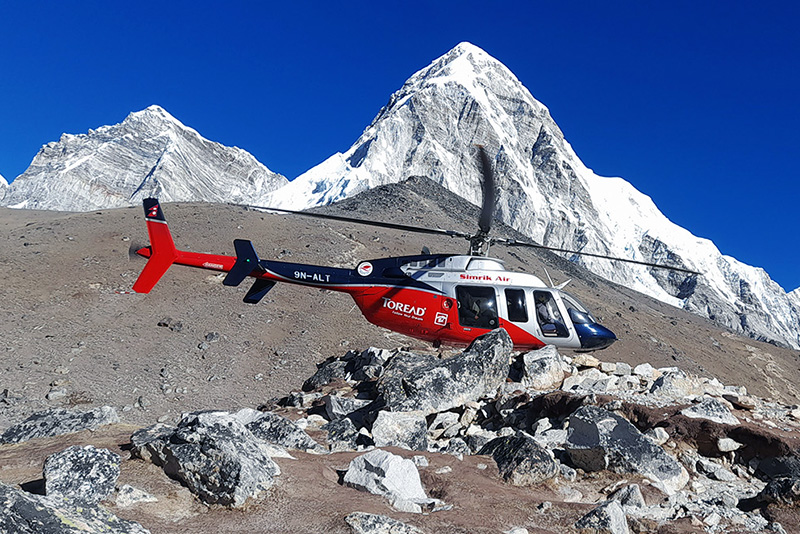
Everest Base Camp Helicopter Tour
Monastery Stay Tour
