Trekking in Annapurna Region
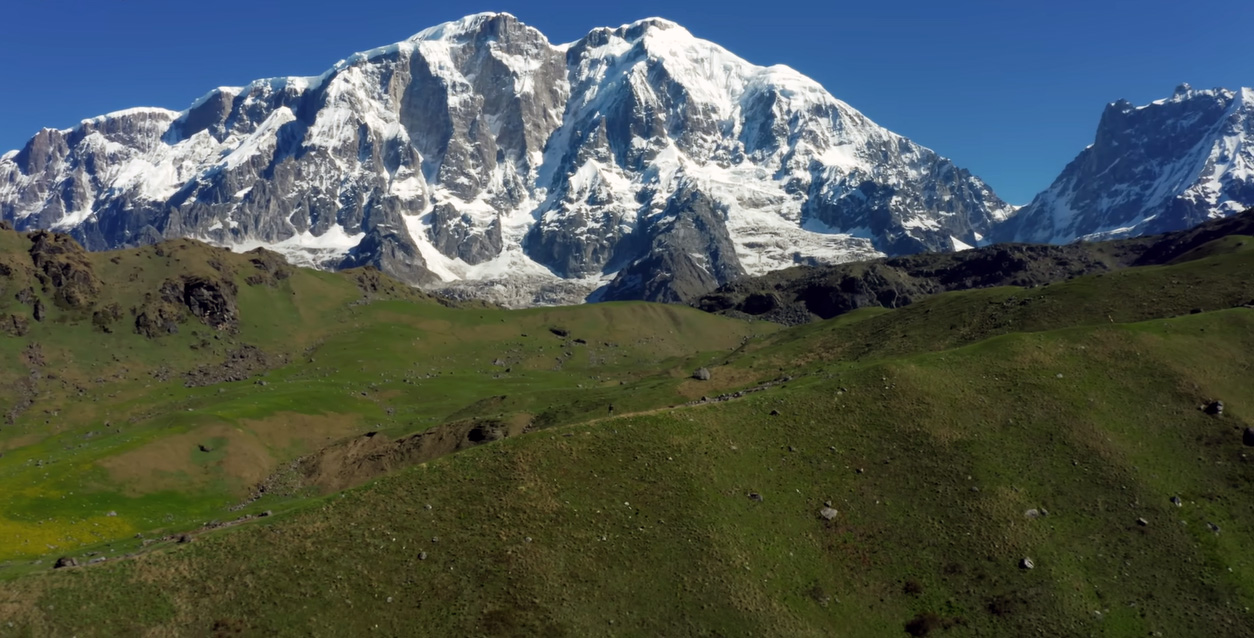
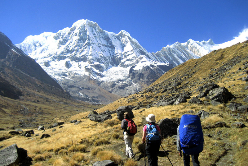
The Annapurna region is the most visited trekking destination in Nepal — not because it is the most famous mountain on the planet, but because it is the most complete trekking experience on it. Within a single week of walking, you can pass through subtropical jungle, ancient Gurung villages, alpine meadows grazed by yaks, arid Tibetan plateau, and a high-mountain pass that sits more than a thousand feet above Everest Base Camp. No other trekking region in the world covers that much ground, that many climates, and that much cultural variation in the same distance.
Stretching across central Nepal between the Marsyangdi River valley in the east and the Kali Gandaki gorge in the west, the Annapurna Conservation Area encompasses 7,629 square kilometers of some of the most geologically dramatic terrain on earth. It is protected as the largest conservation area in Nepal and the most visited, drawing more than 80,000 trekkers per year through a network of trails that ranges from well-maintained teahouse routes to remote ridge walks that see a fraction of that traffic.
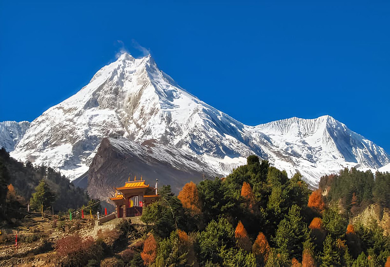
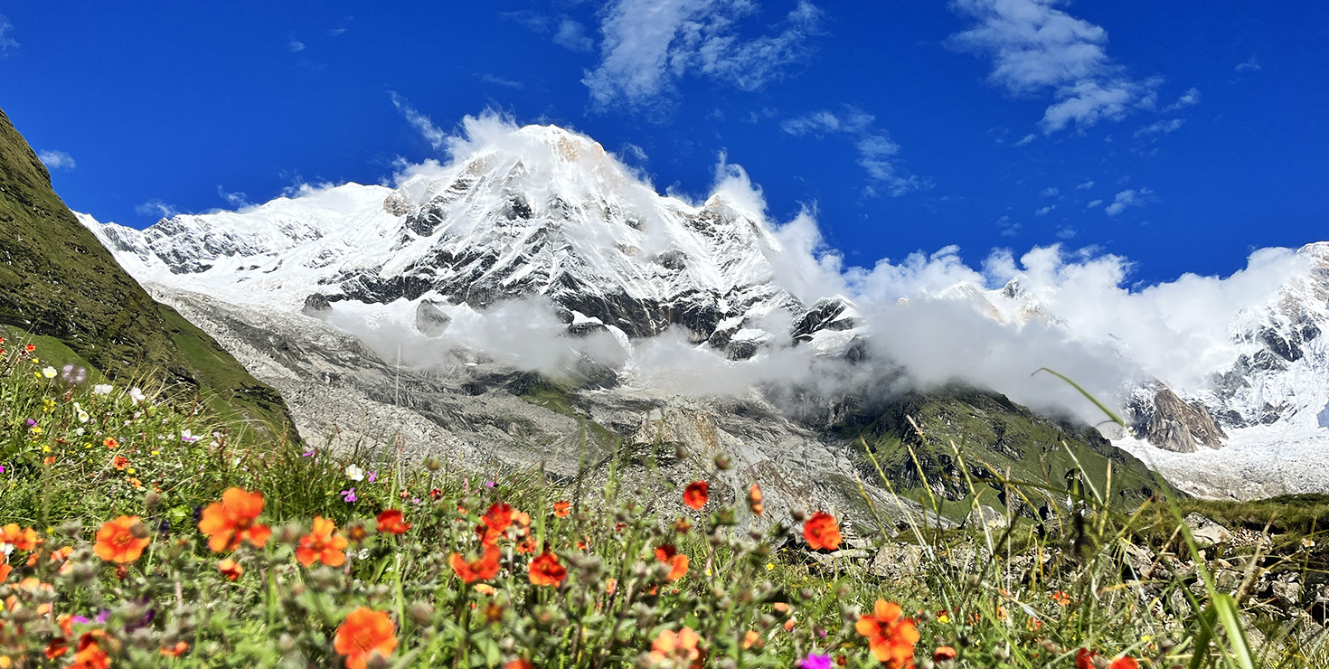
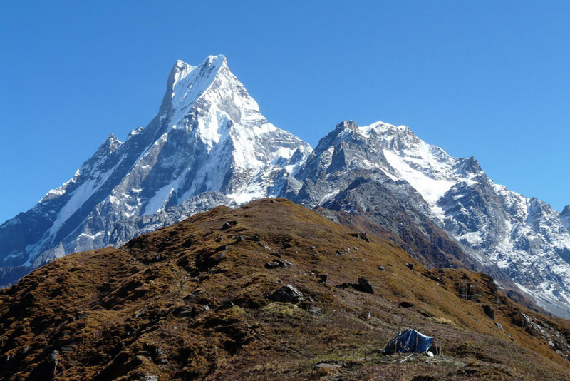
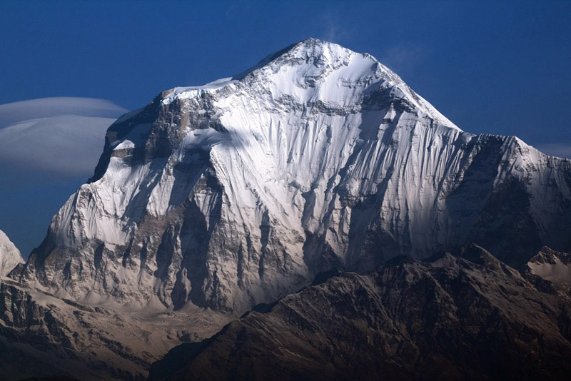
The peaks anchoring this landscape are genuinely extraordinary. Annapurna I, at 8,091 meters, is the tenth-highest mountain in the world and the first 8,000-meter peak to be summited by a human expedition — the French team of Herzog and Lachenal reached its summit in 1950. Alongside it stand Annapurna II, III, IV, and South, Gangapurna, Machapuchare (the sacred fishtail peak that no human has ever been permitted to summit), and Dhaulagiri across the valley — the seventh-highest mountain in the world. Trekking in the Annapurna region means walking in the shadow of more high peaks per day than almost anywhere else on earth.
At Getaway Nepal Adventure, we offer more than ten distinct trekking routes across the Annapurna Conservation Area, from a four-day sunrise walk to Poon Hill suitable for first-time trekkers to a full fifteen-day Annapurna Circuit crossing the 5,416-meter Thorong La Pass. Every route is led by a certified local guide who knows these mountains the way others know their own neighborhood — personally, practically, and with the kind of knowledge that does not come from a guidebook.
Annapurna Region Treks at a Glance
The Annapurna Conservation Area offers more trekking variety than any other single region in Nepal. Whether you have four days or twenty, whether you are a first-time trekker or a seasoned high-altitude walker, the table below will help you find the right route before you click through to the individual package pages.
| Trek | Days | Max Altitude | Difficulty |
| Ghorepani Poon Hill Trek | 9 | 3,210m / 10,531ft | Easy |
| Mardi Himal Trek | 11 | 4,500m / 14,764ft | Easy-Moderate |
| Annapurna Base Camp Trek | 10 | 4,130m / 13,550ft | Moderate |
| Jomsom Muktinath Trek | 10 | 3,800m / 12,467ft | Moderate |
| Tilicho Lake Trek | 12 | 4,949m / 16,237ft | Moderate-Hard |
| Annapurna Dhaulagiri Trek | 13 | 4,700m / 15,420ft | Moderate-Hard |
| Annapurna Circuit Trek | 15 | 5,416m / 17,769ft | Strenuous |
| Annapurna Luxury Trek | 9 | 4,130m / 13,550ft | Moderate |
| Dudh Pokhari Trek with Namunla Pass | 14 | 4,850m / 15,912ft | Hard |
| Kokhe Hill Station Trek | 5 | 2,800m / 9,186ft | Easy |
All packages are fully customizable — departure date, group size, pacing, and accommodation standard can all be adjusted to fit your schedule and budget. Contact our team via WhatsApp for a personalized itinerary at no cost.
Best Time to Trek the Annapurna Region
The Annapurna Conservation Area experiences four distinct seasons, and the quality of your trekking experience changes substantially depending on when you go. Unlike the Everest region, the Annapurna offers genuinely good conditions in more months of the year — but knowing the differences matters.
Spring: March Through May
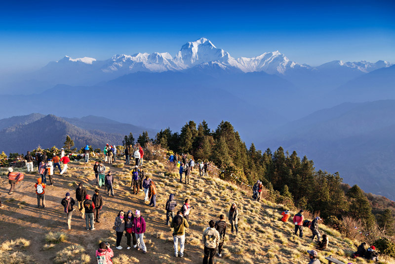
Spring is one of the two peak trekking seasons in the Annapurna region, and it delivers some of the most visually spectacular conditions of the year. From late February through April, the rhododendron forests that cover the lower slopes between 1,800 and 3,500 meters burst into bloom — deep crimson, pink, and white flowers covering the hillsides above Ghorepani, along the Poon Hill route, and throughout the forest sections of the ABC trail. For photographers, this may be the single best time of year.
Temperatures are comfortable for walking: typically 10 to 20 degrees Celsius at lower altitudes, dropping to minus 5 at the higher passes in March before warming through April and May. Skies are generally clear in the mornings with afternoon cloud buildup that rarely brings significant rain until the pre-monsoon showers of late May. Thorong La Pass on the Circuit is usually snowbound through February and clear by late March.
Spring is busy. The main teahouse routes — particularly Ghorepani-Poon Hill and the ABC approach through Chhomrong — see significant foot traffic in April. Book teahouses at least six to eight weeks in advance for popular stops, and plan your Poon Hill sunrise hike for a weekday morning if you want the viewpoint without a crowd. The quieter Mardi Himal ridge route and the upper Circuit beyond Manang remain noticeably less crowded regardless of season.
Autumn: September Through November
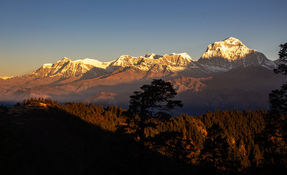
Most trekking professionals in Nepal rate October as the single best month of the year across all Himalayan destinations — and the Annapurna region is no exception. The monsoon ends in mid-September, leaving the air washed clean, the trails recently refreshed, and the vegetation at its greenest. The skies in October and early November are reliably clear, with visibility that regularly extends to a hundred miles in every direction from the high viewpoints.
The light in autumn is extraordinary. Mornings dawn with a deep clarity that photographers spend entire careers chasing, and the low angle of the October sun creates long golden shadows across the terraced rice fields and snowy peaks in a way that spring, with its higher midday sun, cannot replicate. The rice harvest is underway in the lower Gurung villages — another layer of color and activity that gives the trail a warmth and busyness that feels celebratory rather than touristy.
November is colder but still excellent, particularly for the Annapurna Circuit where the high-altitude sections are dramatically clearer after the monsoon. Teahouses above 3,500 meters start to close in late November, so confirm availability if your itinerary goes that high after the first week of the month. The Poon Hill and ABC routes remain well-served through November with no closures.
Winter: December Through February
Winter trekking in the Annapurna region is underrated. Below 3,000 meters — which covers the Poon Hill route and the lower sections of ABC — conditions are cold but perfectly manageable, with temperatures typically between zero and 10 degrees Celsius during the day and cold but dry nights. The trails are quiet, teahouse owners are welcoming and unhurried, and prices are lower across the board.
The Thorong La Pass on the Annapurna Circuit is the critical variable. The pass typically receives significant snowfall from December through February, and conditions can make the crossing genuinely dangerous in heavy snow years. Most experienced operators suspend Circuit treks over Thorong La from December through mid-March unless clients have mountaineering experience and the party is equipped with crampons. The lower-altitude Jomsom Muktinath trek, which uses a jeep road for part of the route, remains a viable winter alternative for those who want the Mustang region experience without the pass.
Monsoon: June Through August
The monsoon arrives in the Annapurna region in early June and dominates through August. Unlike the Everest region, where the monsoon effectively closes trekking on all routes, the Annapurna Conservation Area contains a significant rain-shadow zone in its northern sections. The upper Mustang area and the valley above Manang receive much less rainfall than the southern Annapurna slopes — experienced trekkers use this to plan productive summer itineraries in areas like Jomsom and the Tilicho Lake approach that are accessible from the drier north.
For the standard southern routes — Poon Hill, ABC via Chhomrong, and the lower Circuit sections — the monsoon brings heavy rain, leeches on the lower trails, slippery stone paths, and persistent cloud that eliminates mountain views for days at a time. These routes are not closed, but the conditions are significantly less enjoyable than any other season. If your only available dates fall in June, July, or August, discuss the rain-shadow options with our team — there are workable itineraries, but they require a different approach than the standard routes.
Annapurna Region Trekking Permits 2026
Trekking in the Annapurna Conservation Area requires two permits. Both are straightforward to obtain, and Getaway Nepal Adventure arranges everything in Kathmandu or Pokhara before your trek begins. You will never need to visit a permit office yourself.
| Permit | Cost (Foreign Nationals) | Cost (SAARC Nationals) | Notes |
| Annapurna Conservation Area Permit (ACAP) | NPR 3,000 (~USD 23) | NPR 1,000 (~USD 8) | Mandatory for all Annapurna routes. Valid for one year from issue date. Covers all ACAP routes in a single visit. If bought at the checkpoint instead of in Kathmandu or Pokhara, the fee doubles to NPR 6,000. |
| TIMS Card (Trekkers’ Information Management System) | NPR 1,000 for group trekkers / NPR 2,000 for individual trekkers | Reduced rates apply | Required for Annapurna region treks as of 2026. Issued by Nepal Tourism Board or TAAN offices in Kathmandu or Pokhara. Not the same as the Khumbu permit system — TIMS remains active in the Annapurna region. |
2026 Permit Update: Buy in Kathmandu or Pokhara — Never at the Checkpoint
The ACAP permit costs NPR 3,000 when purchased at the Nepal Tourism Board in Kathmandu or the ACAP office in Pokhara. If you arrive at the Birethanti or Chhomrong checkpoint without a permit, the on-trail price is NPR 6,000 — double the standard rate. Always obtain permits before you start the trail. Getaway Nepal Adventure handles this as part of every standard package, so you will never face this situation when booking with us.
Both permits are checked at multiple points along the trail. Inspectors at Birethanti (for the ABC and Poon Hill routes), Besisahar (for the Circuit), and Chhomrong will ask to see original permits — not photographs on a phone. Keep them in a waterproof document pouch throughout the trek.
Children under 10 years of age do not require an ACAP permit. All other ages pay the standard rate regardless of trek length — the ACAP fee is the same whether you trek for four days or twenty.
For trekking routes that extend into restricted areas adjoining the Annapurna Conservation Area — including Nar Phu Valley, Upper Mustang, or Tsum Valley — additional Restricted Area Permits (RAP) are required and must be obtained through a registered agency. Our team handles all documentation for these routes as part of the package.
Getting to the Annapurna Region
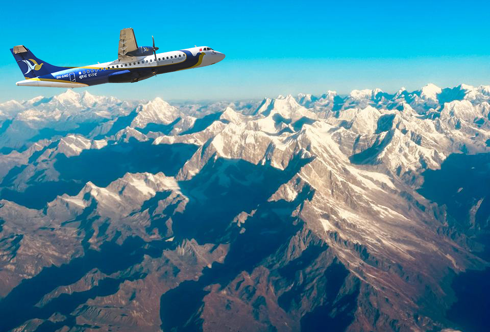
The Annapurna region is one of the most accessible trekking destinations in Nepal. Unlike the Everest region, which requires a flight to Lukla, most Annapurna treks begin from Pokhara or points along the Prithvi Highway — accessible by road from Kathmandu in five to seven hours, or by a twenty-five minute domestic flight.
Option 1: Fly Kathmandu to Pokhara
The Kathmandu to Pokhara domestic flight takes approximately twenty-five minutes and offers extraordinary mountain views on clear days — Annapurna, Manaslu, Dhaulagiri, and Machhapuchhre (Fishtail) are all visible from the right-hand seat heading westbound. Flight frequency is high, with multiple departures daily from Tribhuvan International Airport. Cost is approximately USD 80 to 120 one way depending on season and booking timing.
From Pokhara, your guide arranges a private vehicle to your trek starting point — Nayapul for Poon Hill and ABC routes, or Besisahar for the Annapurna Circuit. The drive from Pokhara to Nayapul takes about ninety minutes.
Option 2: Drive Kathmandu to Pokhara or Trailhead
The Prithvi Highway connects Kathmandu to Pokhara in approximately five to seven hours by private vehicle, depending on traffic and road conditions. This is a comfortable option for groups and travelers who prefer road travel, and it follows the Trisuli and Marsyangdi river valleys through genuinely beautiful mid-hill country. For the Annapurna Circuit, the trailhead at Besisahar or Ngadi is approximately six hours from Kathmandu by direct vehicle, bypassing Pokhara entirely.
For the ABC and Poon Hill routes, the standard approach is to drive to Pokhara first, spend one night, and take a morning vehicle to the trailhead. This break in Pokhara allows time to check gear, confirm permits, and have a relaxed dinner before the walking begins.
Altitude and Acclimatization in the Annapurna Region
The Annapurna region’s altitude range is exceptionally wide — trails begin at around 820 meters in the subtropical Marsyangdi valley and rise to 5,416 meters at Thorong La Pass. This diversity is part of what makes the region extraordinary, but it also means that altitude management is genuinely important, particularly on the Circuit and on longer ABC itineraries.
Key Altitude Points Across Annapurna Treks
| Location | Altitude | Route / Significance |
| Pokhara (starting city) | 827m / 2,713ft | Departure point for most Annapurna treks |
| Poon Hill viewpoint | 3,210m / 10,531ft | Summit of Ghorepani Poon Hill trek — 360° panorama |
| Annapurna Base Camp (ABC) | 4,130m / 13,550ft | Trek destination — surrounded by eight peaks |
| Manang village | 3,519m / 11,545ft | Primary acclimatization stop on Circuit |
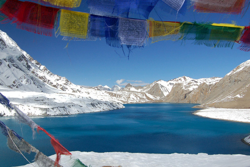
| Tilicho Lake | 4,949m / 16,237ft | One of the world’s highest lakes — Tilicho Lake Trek |
| Thorong La Pass | 5,416m / 17,769ft | Highest point of Annapurna Circuit; higher than EBC |
| Muktinath Temple | 3,800m / 12,467ft | Sacred site at bottom of Thorong La descent |
| Jomsom | 2,720m / 8,924ft | Main Mustang valley town — airport and teahouses |
Acclimatization on the Annapurna Circuit
The Annapurna Circuit is the one Annapurna route where altitude management demands genuine attention. The standard fifteen-day itinerary builds altitude gradually — the Marsyangdi valley approach through Jagat, Tal, and Chame takes four days to reach Manang at 3,519 meters, providing good gradual ascent. At Manang, our itinerary always includes a mandatory rest and acclimatization day. This is non-negotiable.
The acclimatization day at Manang typically involves a short hike to Gangapurna Lake (3,540 meters) or Ice Lake (4,620 meters) — both excellent options that follow the climb-high-sleep-low principle. Many trekkers also visit the Himalayan Rescue Association clinic in Manang, which offers free altitude awareness talks each afternoon during peak season. We strongly recommend attending.
From Manang, the trail rises steadily to Yak Kharka (4,018 meters) and Thorong Phedi (4,450 meters) before the final ascent to Thorong La the following morning. The crossing day is long — typically seven to ten hours of walking — and begins before dawn to ensure the pass is crossed before afternoon winds pick up. Our guides make the call on crossing conditions. If conditions are dangerous, we do not cross.
Altitude on the ABC Trek
The Annapurna Base Camp trek reaches 4,130 meters — high enough that altitude symptoms can affect some trekkers, but not at a level that requires the intensive acclimatization management of the Circuit. Our ten-day ABC itinerary builds altitude over several days through Ghandruk (1,940 meters), Chhomrong (2,170 meters), Deurali (3,230 meters), and Machapuchare Base Camp (3,700 meters) before the final approach to ABC. This gradual progression is intentional. Trekkers who book compressed six or seven-day ABC packages elsewhere tend to have higher rates of altitude-related turnarounds. Our ten-day structure is not padding — it is the reason our trekkers reach the destination.
The People and Villages of the Annapurna Region
The Annapurna region is as much a cultural experience as a physical one. The Conservation Area encompasses dozens of distinct village communities belonging to multiple ethnic groups whose traditions, architecture, languages, and relationship with the mountain environment differ substantially from valley to valley.
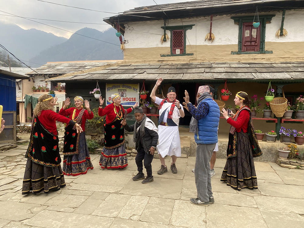
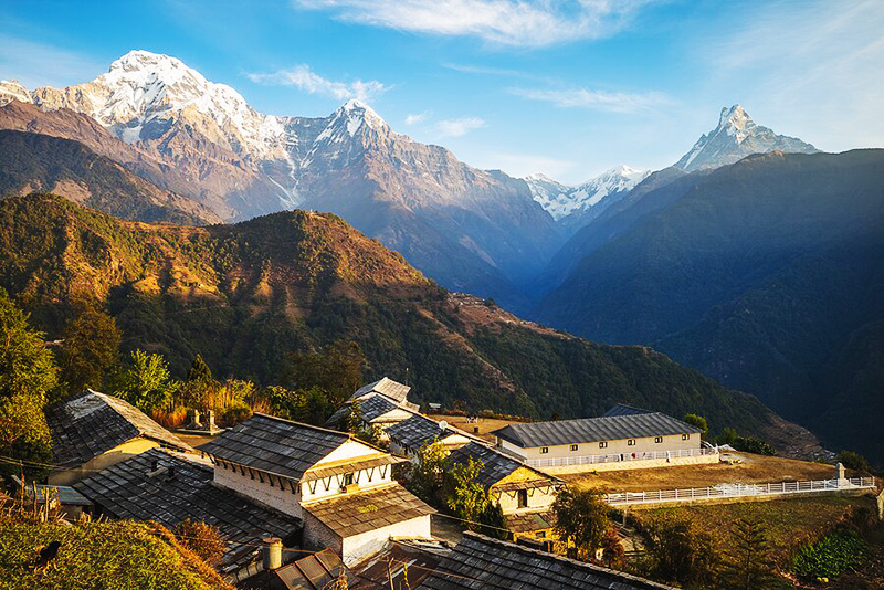
The Gurung Heartland: Ghandruk and the Southern Villages
The villages of Ghandruk, Sirkung, and Chomrong in the southern Annapurna foothills are the heart of Gurung culture in Nepal. The Gurung people have inhabited these steep hillsides for centuries, farming terraced fields of millet, corn, and rice that cascade down the hillside in patterns that take your breath away before you even look up at the peaks. Stone-flagged paths connect the houses, many of them built with the same blue-grey local slate that has been quarried here for generations.
Ghandruk, at 1,940 meters, is the largest Gurung settlement in the region and the cultural reference point for anyone trekking the southern routes. The Gurung Museum at Ghandruk is small but genuinely interesting — it documents the history of the Gurkha soldiers who were recruited from these villages to serve in the British and Indian armies, a tradition that continues and that has profoundly shaped the economy and character of the community. Many of the teahouses in Ghandruk are run by the families of former Gurkha soldiers, and the hospitality is warm in a very particular way.
The Thakali Heartland: Tatopani, Marpha, and the Kali Gandaki
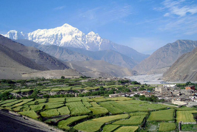
The Kali Gandaki gorge — reportedly the deepest valley on earth, flanked by Annapurna at 8,091 meters and Dhaulagiri at 8,167 meters on either side — is the homeland of the Thakali people, one of Nepal’s most distinctive trading communities. Historically positioned at the crossroads of the salt trade route between Tibet and the lowlands of Nepal, the Thakali built their wealth on commerce and their reputation on exceptional hospitality.
Marpha village, at 2,670 meters in the upper Kali Gandaki valley, is the jewel of this stretch. A whitewashed village of flat-roofed stone houses connected by covered cobblestone alleyways, it is famous for its apple orchards — the area produces some of the finest apples in Nepal, along with apple brandy, apple cider, and apple pie that trekkers on the Circuit talk about for the entire rest of the trek. The village has a functioning irrigation system that is centuries old, running through channels beneath the main street.
The Manang Valley: High-Altitude Tibetan Culture
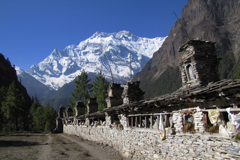
The upper Manang valley, above 3,500 meters, has more in common culturally with Tibet than with the subtropical foothills three days’ walk below. The Nyeshang people of Manang are a trading community with Tibetan Buddhist roots, and their villages — Braga, Manang town, Pisang — reflect this heritage in their flat-roofed mud-brick architecture, their ancient gompas (monasteries), and the extensive mani walls (rows of prayer-carved stones) that line the main trail approaching the valley.
Braga village, just below Manang town, contains one of the oldest monasteries in the Annapurna region — reportedly over 500 years old — with a remarkable collection of clay sculptures and thangka paintings housed in a building that looks, from the outside, more like a fortification than a temple. The monks of Braga conduct morning and evening puja that trekkers are welcome to observe with appropriate respect.
Muktinath: A Sacred Pilgrimage Destination
At 3,800 meters on the far side of Thorong La Pass, Muktinath Temple is one of the most significant sacred sites in all of Nepal — revered simultaneously by Hindus, who know it as one of 108 Vishnu temples, and Tibetan Buddhists, who venerate the natural gas flames that burn within the temple complex as a manifestation of divine energy. The combination of Hindu and Buddhist traditions coexisting in one place — priests performing pujas while Buddhist monks spin prayer wheels — is unusual and genuinely moving.
For trekkers reaching Muktinath after the long crossing of Thorong La, there is an additional and purely practical layer of satisfaction: the descent from the pass is steep and long, the wind on the pass itself can be brutal, and arriving in Muktinath — with its teahouses, hot food, and the extraordinary view back up to the pass you just crossed — provides a visceral sense of completion that few other trekking moments deliver.
How Difficult Are the Annapurna Treks?
The Annapurna Conservation Area is exceptional partly because it offers genuine options for almost every fitness level — from short, low-altitude walks to multi-week high-pass crossings that challenge experienced trekkers. The critical variables are not fitness alone, but altitude response, knee health, and realistic expectations about daily walking hours.
| Trek | Fitness Level | Altitude Challenge | Ideal Candidate |
| Kokhe Hill Station Trek | Low | None (below 3,000m) | First-timers, families, older trekkers wanting a scenic easy walk |
| Ghorepani Poon Hill Trek | Low-Moderate | Mild (max 3,210m) | First-time trekkers, families, trekkers with limited time, beginners |
| Mardi Himal Trek | Moderate | Moderate (max 4,500m) | Trekkers wanting a quieter ABC-level experience with ridge views |
| Annapurna Base Camp Trek | Moderate | Moderate (max 4,130m) | Most adults with basic fitness — most popular Annapurna route |
| Jomsom Muktinath Trek | Moderate | Moderate (max 3,800m) | Trekkers interested in Mustang/Tibetan culture, mixed vehicle-walking |
| Tilicho Lake Trek | Moderate-Strenuous | High (max 4,949m) | Experienced trekkers wanting high-altitude lake without a pass crossing |
| Annapurna Circuit Trek | Strenuous | High (max 5,416m) | Fit and motivated trekkers — the most complete Annapurna experience |
A word on the Annapurna Circuit specifically: the difficulty is not the daily walking distance, which is moderate on most days. The difficulty is the Thorong La Pass crossing — a long, steep, cold ascent to 5,416 meters that starts before dawn and requires both physical conditioning and altitude acclimatization to complete safely. Trekkers who have done the ABC trek and want a step up in challenge will find the Circuit delivers exactly that.
For Poon Hill and ABC trekkers: the standard four-day Poon Hill itinerary is genuinely achievable for most adults with reasonable fitness. The steepest sections — particularly the stone steps above Tikhedhunga — are demanding in the moment but brief. The ten-day ABC trek involves more sustained effort across the middle days, but nothing technically difficult. If you can walk for five to six hours a day on uneven terrain, you can do ABC.
Why Trek the Annapurna Region with Getaway Nepal Adventure
Nepal has hundreds of trekking agencies, and the Annapurna region has more operators per square mile of trail than anywhere else in the country. Most of them can get you to Poon Hill. The question worth asking is not whether an agency can deliver a functional trek — it is whether they will deliver the right one, led by people who genuinely care about what you experience and what happens if things go wrong.
Local Guides, Not Commission Drivers
Every guide we assign to an Annapurna trek is a certified, licensed local guide from the communities along or adjacent to the routes we operate. Our Gurung guides on the ABC and Poon Hill routes grew up in the villages you pass through. They know which family makes the best buckwheat pancakes in Ghorepani, which path above Deurali has the clearest Machapuchare view, and which teahouse owner will open the dining room stove an hour early on cold mornings because they asked nicely. That knowledge is not in a training manual.
We do not use guides who supplement their income by steering trekkers to shops, lodges, or services where they receive commissions. Every recommendation our guides make — for food, accommodation, gear, side trips — is given because it is genuinely the best option for you.
Small Groups, Real Flexibility
Our maximum group size on standard Annapurna treks is twelve trekkers. In practice, most of our groups run between four and eight people, which means the pace is determined by the group itself, rest days can be added when needed, and side trips can be organized spontaneously. A trekker who develops mild altitude symptoms at Deurali gets a genuine rest day, not a “rest morning” before being pushed to continue.
We also accommodate solo travelers, couples, and families with children who want to trek together but are at different fitness levels. Talk to our team about how we structure mixed-level groups — it involves honest route planning, not impossible compromises.
Transparent Pricing, No Surprises
Our package prices are listed per person and include all permits, teahouse accommodation, three meals per day on the trail, certified guide, porter for up to fifteen kilograms of luggage, Pokhara hotel accommodation, and domestic vehicle transfers. International flights, Nepal visa fees, travel insurance, and personal expenses are not included — and we tell you that clearly before you book, not in footnotes.
We do not quote a low price to win a booking and then charge for inclusions that other agencies include as standard. The price we quote is the price you pay. If you ask us for a breakdown, we provide one.
Frequently Asked Questions About Trekking in the Annapurna Region
Q1: What permits do I need to trek in the Annapurna region in 2026?
Two permits are required. The Annapurna Conservation Area Permit (ACAP) costs NPR 3,000 (approximately USD 23) for foreign nationals and must be obtained at the Nepal Tourism Board in Kathmandu, the ACAP office in Pokhara, or through a registered trekking agency. Important: if you buy the ACAP at the trailhead checkpoint instead of in advance, the fee doubles to NPR 6,000. The TIMS card (Trekkers’ Information Management System) is also required for Annapurna region treks and costs NPR 1,000 for group trekkers. Getaway Nepal Adventure obtains both permits for you before your trek starts — bring your passport and two passport-sized photographs.
Q2: What is the best time of year to trek in the Annapurna region?
Autumn (September to November) and spring (March to May) are the two primary trekking seasons. October is widely considered the best single month — clear post-monsoon skies, excellent visibility, and stable temperatures. Spring offers the bonus of rhododendron blooms across the lower routes, making March and April spectacular for photography. Winter (December to February) is cold but viable for lower-altitude treks like Poon Hill. The Annapurna Circuit over Thorong La Pass is generally not advisable from December through February due to snow. Monsoon (June to August) is manageable only on northern rain-shadow routes like the upper Mustang and Manang valleys.
Q3: Which Annapurna trek is best for beginners?
The Ghorepani Poon Hill Trek is the best entry-level option in the Annapurna region. The nine-day itinerary reaches a maximum altitude of 3,210 meters, involves no technical sections, and includes some of the most photographed mountain sunrise views in Nepal — Annapurna South, Dhaulagiri, Machhapuchhre, and Hiunchuli visible simultaneously from the Poon Hill summit. The trail passes through traditional Gurung villages, rhododendron forests (spectacular in spring), and comfortable teahouses throughout. Many first-time trekkers and families with older children complete this route successfully.
Q4: How long does the Annapurna Circuit trek take?
Our standard Annapurna Circuit Trek is fifteen days, which includes the acclimatization day at Manang and allows a comfortable pace throughout. Some operators offer twelve or thirteen-day versions by skipping the acclimatization day or driving sections that were previously walked due to road construction. We do not recommend those abbreviated schedules — the mandatory acclimatization day at Manang exists for safety reasons, and the sections now accessible by road still have excellent alternate walking paths above the road line. The full fifteen-day itinerary is the right call for the Circuit.
Q5: Do I need a guide for Annapurna region trekking in 2026?
As of 2026, the Annapurna Conservation Area (which covers the Circuit, ABC, Poon Hill, Mardi Himal, and most standard Annapurna routes) is exempt from Nepal’s mandatory licensed guide requirement that applies to restricted areas like Manaslu and Upper Mustang. You are legally permitted to trek the standard Annapurna routes without a guide. However, we strongly recommend hiring a certified local guide for safety, local knowledge, emergency support, and the quality of experience. Above 4,000 meters on the Circuit, altitude sickness can develop rapidly. A trained guide monitors your blood oxygen, knows when to stop and when to descend, and provides the kind of practical cultural knowledge that enriches every day on the trail. It is the best investment you will make for your trek.
Q6: How much does an Annapurna trek cost in 2026?
Our Annapurna region packages start from USD 415 for the five-day Kokhe Hill Station Trek and USD 600 for the nine-day Poon Hill Trek. The Annapurna Base Camp Trek (ten days) starts from USD 800. The Annapurna Circuit (fifteen days) starts from USD 1,470. The Annapurna Luxury Trek starts from USD 1,500. All standard packages include ACAP and TIMS permits, teahouse accommodation, three meals per day on the trail, certified guide, one porter per two trekkers, Pokhara hotel accommodation, and all vehicle transfers within the itinerary. International flights, Nepal visa, travel insurance, and personal spending are excluded.
Q7: How do I get from Kathmandu to the start of Annapurna treks?
Most Annapurna treks begin from Pokhara, which is 200 kilometers west of Kathmandu. You can reach Pokhara by domestic flight (twenty-five minutes, approximately USD 80 to 120) or private vehicle on the Prithvi Highway (five to seven hours). From Pokhara, a private vehicle takes you to the specific trailhead: Nayapul for Poon Hill and ABC routes (ninety minutes), or Besisahar for the Circuit start (three hours). Getaway Nepal Adventure arranges all transfers between Kathmandu, Pokhara, and the trailhead as part of every standard package.
Q8: Is altitude sickness a concern on Annapurna treks?
It depends significantly on which trek you choose. For the Ghorepani Poon Hill Trek (maximum 3,210 meters), altitude sickness is uncommon and rarely serious when the schedule is followed. For the Annapurna Base Camp Trek (4,130 meters), mild altitude symptoms — headache, fatigue, disrupted sleep — affect some trekkers at the highest camps but are manageable with rest and hydration. For the Annapurna Circuit with the Thorong La Pass crossing (5,416 meters), altitude sickness is a real risk that requires proper acclimatization at Manang, a slow approach pace, and awareness of AMS symptoms. Our guides carry pulse oximeters, are trained in altitude first aid, and are authorized to make unilateral descent decisions. No summit goal is worth ignoring altitude symptoms.
Q9: What is Thorong La Pass, and how difficult is crossing it?
Thorong La Pass sits at 5,416 meters above sea level — higher than Everest Base Camp — and is the highest point of the Annapurna Circuit trek. It is not a technical climb; it does not require ropes, crampons (in standard conditions), or mountaineering experience. What it requires is cardiovascular fitness, proper acclimatization after several nights above 3,500 meters, an early start (typically 4:00 to 5:00 AM), and the physical and mental readiness for seven to ten hours of sustained walking. Oxygen levels at 5,416 meters are approximately half of sea-level concentration. The descent to Muktinath on the far side is steep, long, and hard on the knees. Trekking poles are strongly recommended for the crossing day in both directions.
Q10: Can families with children trek in the Annapurna region?
Yes — the Annapurna region is one of the best destinations in Nepal for family trekking, specifically on the lower-altitude routes. The Ghorepani Poon Hill Trek is regularly completed by families with children aged eight and above. The trail is well-maintained, teahouses are family-friendly, the maximum altitude of 3,210 meters is safe for children without altitude concerns, and the cultural experience — Gurung villages, rhododendron forests, mountain panoramas — is immediately engaging for kids. The Annapurna Base Camp Trek is achievable for fit teenagers but not recommended for younger children due to the sustained daily distances and altitude above 4,000 meters. Contact our team to discuss the right Annapurna family itinerary for your children’s ages and fitness levels.
Top Add-on Trips
Everest Base Camp Helicopter Tour
Monastery Stay Tour