Trekking in Manaslu Region
Nepal’s most rewarding restricted-area trek
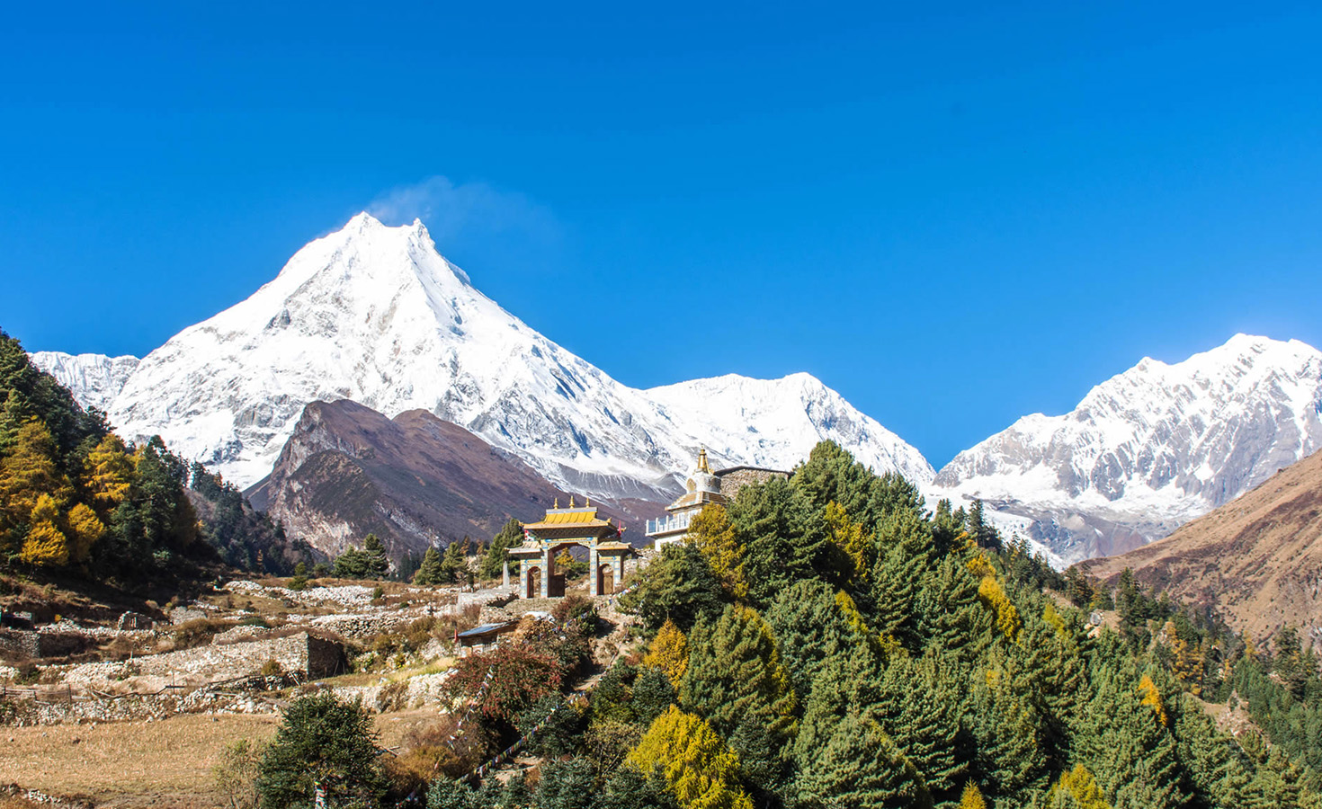
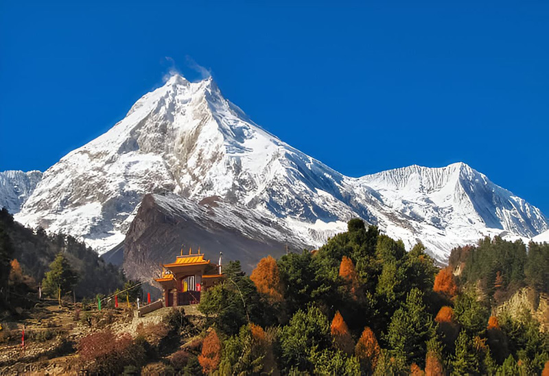
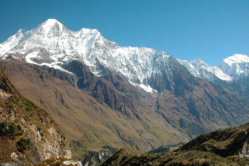
The Manaslu region occupies a position in Nepal’s trekking landscape that is genuinely singular: it delivers the high-altitude grandeur, cultural depth, and geographic drama of the most celebrated Himalayan routes — but in a restricted area that receives a fraction of the foot traffic of Everest or Annapurna. The region takes its name from Mount Manaslu, which rises to 8,163 meters and stands as the eighth-highest mountain on earth. It is a name that carries weight in mountaineering history — the first ascent in 1956 by a Japanese expedition led by Toshio Imanishi and climber Gyalzen Norbu opened a new chapter in Himalayan climbing, and Manaslu remains one of the most technically demanding 8,000-meter peaks. Trekkers walking the circuit at its base are never far from an awareness that they are in the orbit of something genuinely immense.
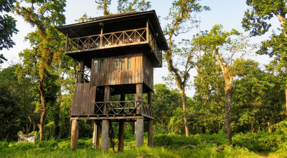
The Manaslu Conservation Area, established in 1998 and covering 1,663 square kilometers of the Gorkha and Dhading districts in central Nepal, protects one of the most ecologically diverse landscapes in the entire Himalayan range. The conservation area spans six major ecological zones, from the subtropical Buri Gandaki river gorge below 1,000 meters to the glacial alpine terrain above 5,000 meters. This vertical span produces extraordinary biodiversity: snow leopards, red pandas, Himalayan black bears, musk deer, ghoral, and over 110 bird species have been recorded within the conservation boundary. The forests that trekkers walk through in the lower gorge sections contain rhododendron, oak, pine, fir, and bamboo in concentrations that reflect the altitude transitions with unusual clarity. At higher elevations, yak pastures and glacial moraines replace the forest, and the landscape takes on the stripped-back character of the Tibetan plateau that lies just beyond the northern border.
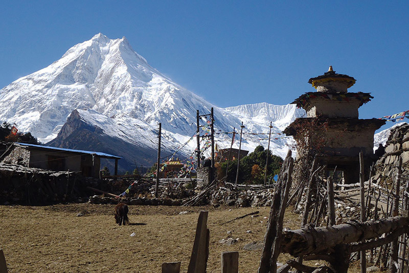
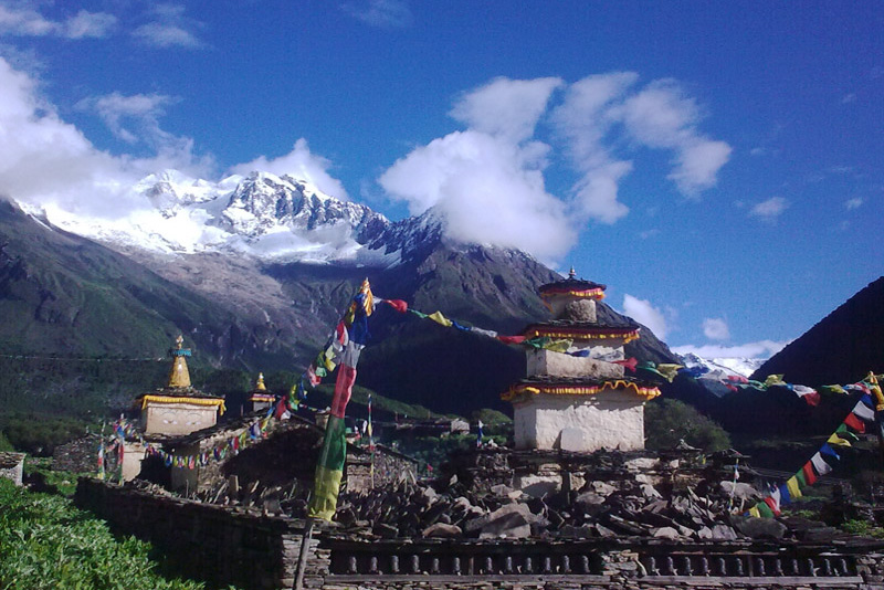
The human communities of the Manaslu region represent two distinct cultural worlds separated by altitude. In the lower gorge — the Buri Gandaki river valley — Gurung and Magar villages follow agricultural patterns connected to the mid-hill Nepal of the south. As the trail climbs above 2,500 meters into the Nubri Valley, the cultural context shifts completely. The Nubri people are ethnically and linguistically Tibetan, descendants of communities that crossed the mountain passes from Tibet centuries ago and settled in the high valleys of the conservation area. Their villages — Lho, Sho, Samagaun, Samdo — are built from the same flat-roofed stone construction as settlements on the Tibetan plateau, and their monasteries practice the Nyingma and Kagyu traditions of Tibetan Buddhism that connect them spiritually to a world that exists north of the mountains.
The Tsum Valley, a side valley that branches off the main Manaslu Circuit route near Jagat, adds a third dimension to the region’s cultural landscape. Tsum was closed to foreign visitors until 2008, and even today fewer than 2,000 trekkers enter the valley annually — making it one of the quietest and most authentically preserved trekking destinations in the entire Himalayan world. The Tsumba people practice a tradition called Shyagya — a principle of non-violence that means no animals are hunted or slaughtered in the valley. The result is a landscape where wildlife moves freely through villages, where monasteries perch on ridgelines above cultivated fields, and where a quality of peace saturates the trail that experienced trekkers describe as unlike anywhere else they have been.
At Getaway Nepal Adventure, we run seven distinct routes across the Manaslu region — from the eleven-day Manaslu Short Trek to the comprehensive twenty-day Manaslu Tsum Valley Trek. Every route in this region is a restricted area itinerary, requiring multiple permits, a mandatory licensed guide, and logistical preparation that is substantively more complex than the open trekking regions of Nepal. We handle all of it. What we ask of you is fitness, patience, and a genuine appetite for the kind of trekking experience that the over-developed routes simply cannot offer.
Manaslu Region Treks at a Glance
The Manaslu region offers more route variety than its reputation as a single-circuit destination suggests. Seven distinct itineraries cover a wide range of durations, difficulty levels, and cultural emphasis. The table below gives you the critical comparison data before you explore each package in detail.
| Trek | Days | Max Altitude | Difficulty |
| Manaslu Short Trek | 11 | 4,200m / 13,779ft | Moderate |
| Lower Manaslu Trek | 12 | 3,800m / 12,467ft | Moderate |
| Manaslu Circuit Trek | 13 | 5,160m / 16,929ft | Strenuous |
| Tsum Valley Trek | 12 | 3,700m / 12,139ft | Moderate |
| Manaslu Base Camp Trek | 15 | 4,800m / 15,748ft | Strenuous |
| Rupina La Pass Trek | 18 | 4,660m / 15,289ft | Strenuous |
| Manaslu Tsum Valley Trek | 20 | 5,160m / 16,929ft | Strenuous |
All Manaslu region packages are fully customizable by departure date and group size. Every itinerary includes all mandatory permits, licensed guide, and the logistical preparation that restricted-area trekking in Nepal requires. Contact our team to discuss the right route for your available time, fitness level, and specific interests.
The Manaslu Circuit Trek: The Crown Jewel of the Region
The Manaslu Circuit Trek is the route that defines the region’s trekking reputation — a full clockwise loop around Mount Manaslu covering approximately 177 kilometers over thirteen to eighteen days, crossing the Larkya La Pass at 5,160 meters, and traversing six ecological zones from subtropical gorge to glacial alpine. It is graded strenuous and earns that grade honestly: the altitude gain from the trailhead at Soti Khola (710 meters) to the summit of Larkya La is more than 4,450 meters of vertical rise. By the time trekkers stand on the pass, the air pressure is approximately 50 percent of what it is at sea level.
The circuit begins with a long drive from Kathmandu — seven to eight hours to Soti Khola or Machha Khola, which now has a road that shortens the traditional walking approach by four to five hours. The first days follow the Buri Gandaki gorge northward through some of the most dramatic river gorge scenery in Nepal: vertical walls of rock, cascading waterfalls, hanging bridges, and dense forest that alternates between subtropical and temperate as altitude increases. The gorge section is not what most trekkers expect from a high-altitude circuit — it is genuinely wild, occasionally narrow, and logistically demanding in a way that the upper valley is not. This is the section where the Manaslu Circuit earns its reputation for genuine remoteness.
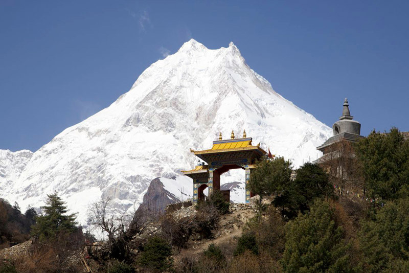
Above Jagat, the valley opens and the cultural landscape shifts. Nubri villages begin appearing — Deng, Namrung, Lho, Sho — each with their own monastery, mani walls, and the flat-roofed stone architecture of the Tibetan plateau tradition. The village of Lho, at 3,180 meters, sits in a wide meadow directly across from one of the finest close-range views of Mount Manaslu’s north face anywhere accessible without technical climbing equipment. The scale of the mountain from Lho is genuinely startling — not a distant pyramid but an immense wall of ice and rock that occupies the northern sky. Most trekkers spend time at Lho simply looking.
Sama Gaun and the Acclimatization Approach
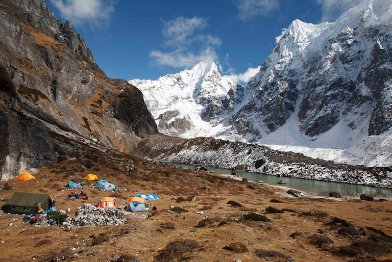
Sama Gaun (also written Samagaun) at 3,530 meters is the primary acclimatization village on the Manaslu Circuit and the most important single stop on the entire route. All serious operators build at least one full rest day here — not because the walking is hard at this point, but because the acclimatization days at Sama Gaun and Samdo are what make the Larkya La crossing physiologically possible. Our itinerary uses the acclimatization day for a side excursion to either Birendra Lake (3,450 meters) or the approach to Manaslu Base Camp (4,800 meters) — a classic climb-high-sleep-low protocol that measurably improves altitude adaptation.
The Manaslu Base Camp side trip from Sama Gaun is one of the most underrated high-altitude excursions in Nepal. The base camp sits beneath the towering southeast face of Manaslu at approximately 4,800 meters, with views of the Manaslu Glacier and the route lines of expeditions attempting the peak during spring and autumn climbing seasons. The round trip from Sama Gaun takes six to eight hours and is achievable without technical equipment. The altitude gained (nearly 1,300 meters above Sama Gaun) provides excellent acclimatization preparation for the Larkya La crossing two to three days later.
Larkya La Pass: The High Point of the Manaslu Circuit
The Larkya La Pass at 5,160 meters is the physical and psychological centerpiece of the Manaslu Circuit Trek — the crossing that everything before it builds toward and everything after it descends from. At 5,160 meters, Larkya La is one of the highest trekking passes in Nepal that does not require technical mountaineering equipment. There are no ropes, no ice axes required under standard conditions. What it does require is proper acclimatization, physical conditioning, an early start, and a clear understanding of what crossing takes out of the body.
The Crossing Day
Every experienced operator starts the Larkya La crossing between 3:00 and 4:00 AM from Dharamsala (4,460 meters), the final overnight stop before the pass. The reasons are both practical and safety-critical: afternoon weather on the pass is unpredictable, winds can reach 50 kilometers per hour or higher after midday, and clouds frequently reduce visibility to near zero by early afternoon. Starting before dawn in sub-zero darkness is not adventure for its own sake — it is the standard protocol for safe passage.
The ascent from Dharamsala climbs steadily across rocky moraine, frozen stream crossings, and intermittent snow fields. The terrain above 4,800 meters is exposed and wind-scoured. Breathing becomes noticeably labored for most trekkers, even those who have acclimatized well. The final push to the pass prayer flags — where photos are taken, altitude is celebrated, and the westward view across the Dudh Khola valley and toward the Annapurna massif opens for the first time — takes most trekkers between four and five hours from Dharamsala.
The descent is not easier than the ascent. A 1,400-meter drop from the pass to Bimthang (3,590 meters) over steep, knee-testing terrain requires equal concentration. Most trekkers’ knees know about the Larkya La for days afterward. Trekking poles are not optional equipment on the Manaslu Circuit — they are essential, and you will use them most intensively on the descent from Larkya La to Bimthang.
What You See from the Pass
On a clear day — which the early morning start is designed to deliver — the summit views from Larkya La are among the finest in Nepal. Looking north and east, the Manaslu massif and its satellite peaks dominate the skyline. To the south and west, the Annapurna range becomes visible: Annapurna II, III, and IV are all identifiable from the pass in good conditions, and the descent reveals a progressively expanding panorama as the trail drops into the Dudh Khola valley. The transition from the austere, glacier-framed north to the greener, more complex landscape of the Annapurna side happens over the course of a single descent day and provides a visual summary of the entire circuit’s geographic range.
Manaslu Region Trekking Permits 2026: Everything You Need to Know
The Manaslu region is one of Nepal’s most permit-intensive trekking destinations. Most routes require three mandatory permits, and Tsum Valley requires a fourth. Understanding the permit structure before you book prevents surprises — and the surprises at the Jagat checkpoint (where officers have turned back improperly documented trekkers) are not the kind you want on a trip of this investment.
Critical Rules for Manaslu Permits in 2026
- Minimum group size: TWO non-Nepali trekkers required for the Restricted Area Permit (RAP).
(Note: As of 2026 this rule remains in effect for Manaslu — unlike Upper Mustang which lifted it in March 2026.) - Licensed guide mandatory: Solo or guideless trekking in the restricted area is not permitted.
- TIMS card: NOT required for the Manaslu Circuit as of 2024-2026 (unless continuing to Annapurna).
- Permits issued: Kathmandu Department of Immigration only — not at trailhead checkpoints.
- Processing time: Allow at least 2 full working days in Kathmandu. Not issued on weekends or public holidays.
- Digital checkpoints: As of 2026, Jagat and other major checkpoints use digital tracking. Your RAP is logged against your passport at entry. Checkpoint officers cross-reference documentation every time.
| Permit | Cost (Foreign Nationals) | Season | Notes |
| Restricted Area Permit (RAP) | USD $100 per person / first 7 days then USD $15/day additional | September–November (Autumn) | Must be obtained through a registered agency. Not available independently. Minimum 2 non-Nepali trekkers. |
| Restricted Area Permit (RAP) | USD $75 per person / first 7 days then USD $10/day additional | December–August (Spring, Winter, Summer) | Same rules apply. Same agency requirement. Autumn rate is higher due to peak demand. |
| Manaslu Conservation Area Permit (MCAP) | NPR 3,000 (USD 23) — flat fee | All seasons | Obtained at Nepal Tourism Board (NTB) office, Kathmandu. SAARC nationals: NPR 1,000. |
| Annapurna Conservation Area Permit (ACAP) | NPR 3,000 (USD 23) — flat fee | All seasons | Required because the circuit descends into the Annapurna Conservation Area after Larkya La. Same ACAP used for both Manaslu and Annapurna if continuing. |
| Tsum Valley Permit (additional) | USD $40 per person / first week; USD $7/day thereafter | All seasons | Required only for Tsum Valley side trip or standalone Tsum Valley trek. Obtained through agency. |
| Chumnubri Rural Municipality Permit | NPR 1,000 per person (USD 8) approx. | All seasons | Local municipality fee applied in some itinerary variants. Your agency confirms requirement. |
Example total permit cost for a standard 14-day Manaslu Circuit Trek in autumn (September–November):
- RAP: USD $100 for first 7 days + USD $15 × 7 additional days = USD $205 per person
- MCAP: USD $23 per person (flat fee)
- ACAP: USD $23 per person (flat fee)
Total: approximately USD $251 per person in permit fees for a 14-day autumn circuit
For spring (December–August, which includes the spring trekking season March–May):
- RAP: USD $75 for first 7 days + USD $10 × 7 additional days = USD $145 per person
- MCAP + ACAP: USD $46 combined
Total: approximately USD $191 per person in permit fees for a 14-day spring circuit
Getaway Nepal Adventure handles all permit applications, documentation, and agency coordination for every Manaslu package. We submit your RAP application at the Department of Immigration in Kathmandu, obtain your MCAP and ACAP at the Nepal Tourism Board, and confirm all documentation is in order before your departure. You need to provide your passport, Nepal visa, passport-sized photographs, and proof of travel insurance.
Getting to the Manaslu Region from Kathmandu
The Manaslu Circuit and Tsum Valley treks are road-accessed from Kathmandu — no domestic flight required. The drive to the trailhead follows the Prithvi Highway westward before turning north along the Buri Gandaki valley.
Drive to Soti Khola or Machha Khola
The traditional starting point for the Manaslu Circuit Trek was Soti Khola (710 meters), reached by an approximately seven to eight-hour drive from Kathmandu via Arughat. A road extension now reaches Machha Khola (930 meters) and, in some conditions, further north — eliminating four to five hours of walking from the traditional lower gorge approach. Most agencies now start their circuits at Machha Khola or Jagat depending on road conditions and client preference.
The drive from Kathmandu to Machha Khola follows the Prithvi Highway to Arughat before turning north along an unpaved mountain road. The road quality varies by season — in good conditions the drive takes six to seven hours; after heavy rain, conditions on the unpaved sections can extend this. We use private 4WD vehicles rather than local buses for all trailhead transfers, which improves both speed and comfort on the unpaved sections significantly.
Returning from Besisahar or Dharapani
The Manaslu Circuit ends at Dharapani (1,960 meters) in the Annapurna region after crossing Larkya La and descending through Bimthang. From Dharapani, the standard return route connects to the Annapurna Circuit road — a drive to Besisahar, then to Kathmandu via the Prithvi Highway, taking approximately five to six hours in total. This one-way circuit approach means no backtracking on the trail — you end in a different valley from where you started, which most trekkers experience as satisfying rather than convenient.
The Tsum Valley: Nepal’s Most Sacred Hidden Valley
The Tsum Valley is not a side trip. For the trekkers who enter it — and they are fewer than 2,000 per year — it is the reason they came to the Manaslu region in the first place. Closed to foreign visitors until 2008, Tsum (derived from the Tibetan word “Tsombo,” meaning vivid or brilliant) is a U-shaped glacial valley in the northern Gorkha district, enclosed on three sides by the Ganesh Himal, Boudha Himal, and Sringi Himal ranges and sealed by the Tibetan border to the north. The valley was opened only after extensive lobbying by conservation organizations who recognized that the combination of intact Tibetan Buddhist culture, extraordinary monastery heritage, and the Tsumba people’s tradition of Shyagya (non-violence) made it one of the most culturally significant and ecologically intact valleys left in the Himalayan world.
The Tsumba People and the Tradition of Shyagya
The Tsumba people — the ethnic community of Tsum Valley — practice a tradition of non-violence rooted in their Buddhist faith that is rare in the Himalayan world and possibly unique in its completeness. No animals are hunted or slaughtered within the valley. Wildlife moves freely between villages and agricultural land without fear of human predation. The result is a valley where tahr, musk deer, and Himalayan birds occupy the same spaces as the human community, and where the ecological relationship between the inhabitants and the landscape is one of coexistence rather than extraction.
This tradition is not a modern conservation policy. It is centuries old, maintained through religious conviction and community agreement, and embedded in the social fabric of the valley in a way that makes it self-enforcing. Trekkers who enter Tsum Valley carry their own food supplies for meat if needed, as nothing of that kind is available within the valley itself. Most find that the experience of eating what the community eats — grain-based, dairy-supplemented, seasonal — adds to rather than diminishes the immersion.
The Monasteries of Tsum Valley
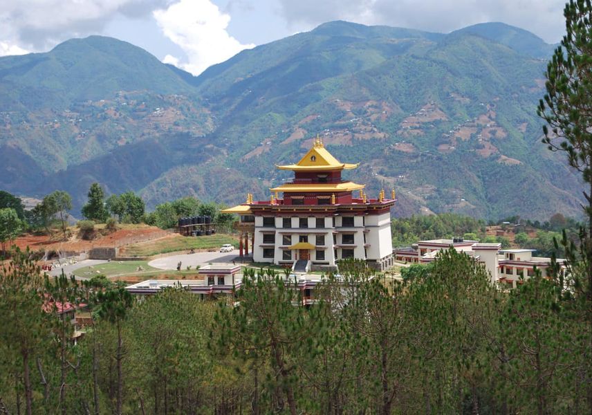
Mu Gompa, perched at 3,700 meters on a ridge above the upper valley near the Tibetan border, is the largest and most significant monastery in Tsum Valley. Founded centuries ago in the Nyingma tradition of Tibetan Buddhism, it houses monks, young novice students, and a collection of ancient artifacts and religious paintings that represent the cultural continuity of a tradition that has survived largely unchanged since the valley was settled. The approach to Mu Gompa from the valley floor is itself spectacular — the monastery appears on a ridgeline above a wide, flat upper valley floor, framed by the snow-covered peaks of the Tibetan border mountains. Morning puja can be observed by respectful visitors.
Rachen Gompa, a significant nunnery in the lower-upper valley section, houses an extraordinary collection of handcrafted murals and clay statues that represent one of the finest concentrations of traditional Tibetan Buddhist art accessible to trekkers anywhere in Nepal. The nuns of Rachen welcome visitors who approach with appropriate respect and curiosity, and the monastery provides a distinctly different experience from Mu Gompa’s male monastic tradition.
The Milarepa Cave, associated with the great 11th-century Tibetan Buddhist yogi and poet Milarepa — one of the most revered spiritual figures in the Kagyu tradition of Tibetan Buddhism — is accessible on a day hike from the upper valley villages. According to oral tradition preserved in the valley, Milarepa meditated in this cave during his travels through the high Himalayas. Whether the historical attribution is precise or legendary, the site carries a spiritual atmosphere that many trekkers find genuinely affecting, and its position above the valley floor provides a comprehensive view of the Tsum landscape.
Combining Tsum Valley with the Manaslu Circuit
The twenty-day Manaslu Tsum Valley Trek combines both routes in a single itinerary — entering Tsum Valley on the approach to the main circuit, acclimatizing in the valley’s upper reaches (which reach 3,700 meters at Mu Gompa), and then re-joining the main Manaslu Circuit route for the ascent to Sama Gaun and the Larkya La crossing. This sequence is strongly recommended over the reverse (circuit first, Tsum second) because the acclimatization gained in Tsum Valley at 3,000 to 3,700 meters significantly reduces the altitude stress of the main circuit’s upper sections. Trekkers who do Tsum Valley first cross Larkya La with better-adapted bodies than those who attempt it directly.
Best Time to Trek the Manaslu Region
The Manaslu region has the same two primary trekking windows as most Himalayan destinations, but its restricted access and gorge-based approach make seasonal timing more important here than on open routes.
Autumn: September Through November — The Best Season
Autumn is the premier season for Manaslu trekking, and October is the finest month within it. The monsoon clears in mid-September, leaving the forests in the lower Buri Gandaki gorge luminously green, the waterfalls at peak flow, and the sky above the upper valley crystalline. Views of Manaslu’s north face from Lho and Sama Gaun in October are exceptional — clear, detailed, and unobstructed by the afternoon cloud that builds throughout spring. The Larkya La crossing is typically in the best conditions of the year during late September through October, with consolidated snow on the pass and minimal wind.
November remains excellent but brings progressively colder temperatures above 4,000 meters and some teahouse closures in the upper valley from mid-month. The RAP permit rate is also at its autumn high (USD $100 for the first week) during this period, reflecting the premium conditions.
Spring: March Through May — The Second Season
Spring is the second major trekking window and offers a genuinely different experience from autumn. The lower gorge sections bloom in March and April with rhododendron and wildflowers visible from the trail through the forested zones. Snow at the Larkya La in early spring can be deeper than autumn, making the crossing more demanding in March and sometimes requiring crampons. By April and May, conditions on the pass stabilize. The spring RAP rate is lower (USD $75 for the first week) than autumn.
One practical consideration for spring planning: the road to Machha Khola and Soti Khola passes through areas that can experience post-winter road damage. Early spring starts (March) should confirm road conditions before departure. We monitor this for every spring booking and advise accordingly.
Monsoon and Winter: Not Recommended
The Manaslu region’s lower gorge sections receive heavy monsoon rainfall from June through August. Unlike the Mustang region, there is no rain shadow here — the Buri Gandaki gorge is fully exposed to monsoon precipitation, and the trail through it becomes genuinely hazardous with landslides, swollen river crossings, and trail washouts. We do not operate Manaslu Circuit treks during the monsoon season.
Winter trekking (December through February) is possible in the lower and mid-valley sections but is not recommended for the full circuit. The Larkya La is frequently closed by snow from December through February, and temperatures at Dharamsala and the pass itself drop to dangerous lows for trekkers without mountaineering cold-weather equipment. The Tsum Valley, with its lower maximum altitude of 3,700 meters, remains viable in early December for experienced winter trekkers.
Altitude and Acclimatization on the Manaslu Circuit
The Manaslu Circuit covers a wider altitude range in a shorter geographic distance than almost any other standard Himalayan trek. Starting near the valley floor at 710 meters and reaching 5,160 meters at Larkya La, the circuit demands the most carefully managed acclimatization schedule of any open-market trek in Nepal.
| Location | Altitude | Trek Stage / Significance |
| Soti Khola / Machha Khola | 710–930m | Trek start — subtropical gorge zone |
| Jagat | 1,349m | First permit checkpoint — restricted area begins |
| Deng | 1,804m | Mid-gorge village — cultural transition begins |
| Namrung | 2,630m | Entry into Nubri territory — monastery visits begin |
| Lho Gaon | 3,180m | Best Manaslu north face viewpoint on the trail |
| Sama Gaun (Samagaun) | 3,530m | Primary acclimatization stop — mandatory rest day |
| Samdo | 3,850m | Second acclimatization village before pass |
| Dharamsala | 4,460m | Final overnight before Larkya La crossing |
| Larkya La Pass | 5,160m | Circuit high point — 50% oxygen of sea level |
| Bimthang | 3,590m | First overnight after pass — significant descent |
| Dharapani | 1,960m | Circuit end — Annapurna Conservation Area |
| Mu Gompa (Tsum Valley) | 3,700m | Tsum Valley high point — largest monastery |
The most critical acclimatization decision on the Manaslu Circuit is the approach to Larkya La. The jump from Samdo at 3,850 meters to the pass at 5,160 meters — a gain of 1,310 meters — happens over two days via Dharamsala. Without the proper acclimatization at Sama Gaun and Samdo (including side trips to Birendra Lake or Manaslu Base Camp), the body is not adequately prepared for that gain. Our guides make the acclimatization day decision based on how each individual trekker is responding — signs of AMS at Sama Gaun mean an extra rest day, regardless of schedule. We have never compromised on this, and it is the reason our circuit completion rate is higher than the industry average.
How Difficult Is Trekking in the Manaslu Region?
The Manaslu Circuit is graded strenuous — a grade it earns through cumulative altitude gain, daily distance, and the demands of the Larkya La crossing, not through technical difficulty. No ropes, no ice axes, no climbing skills are required under standard conditions. What is required is a genuine baseline of cardiovascular fitness, prior experience on multi-day mountain treks, and realistic respect for what altitude does to the body.
| Route | Fitness Required | Key Challenge | Suitable For |
| Manaslu Short Trek | Moderate | Lower altitude, shorter duration — the most accessible route in the region | Fit first-timers wanting a Manaslu taste; trekkers with limited time |
| Lower Manaslu Trek | Moderate | Gorge sections — steep trail, river crossings, no technical altitude challenge | Those wanting cultural immersion without the Larkya La commitment |
| Tsum Valley Trek | Moderate | Cultural route — sustained walking in remote terrain, 3,700m max altitude | Cultural travelers; trekkers wanting depth over altitude |
| Manaslu Circuit Trek | Strenuous | Larkya La Pass at 5,160m — altitude, cold, long crossing day, knee-testing descent | Experienced trekkers with prior high-altitude history; strong cardiovascular fitness |
| Manaslu Base Camp Trek | Strenuous | Sustained high altitude; approach to 4,800m base camp | Mountaineering enthusiasts; those wanting Manaslu proximity without the circuit |
| Manaslu Tsum Valley Trek | Strenuous | Combined 20-day itinerary — the longest and most comprehensive option | Committed trekkers with 3+ weeks and appetite for the full experience |
If you have completed the Annapurna Base Camp Trek or the Langtang Valley Trek and are ready for a significant step up in duration, altitude, and challenge, the Manaslu Circuit is the natural progression. If you have done EBC or the Annapurna Circuit and want something genuinely off the main path, Manaslu delivers. The permit and guide requirements are more complex, the crowds are dramatically fewer, and the cultural experience — particularly in the upper Nubri valley — is more authentic than anything the open-access regions currently offer.
Why Trek the Manaslu Region with Getaway Nepal Adventure
The Manaslu region is the most logistically demanding of the five major restricted trekking areas in Nepal. Four permits, mandatory guide requirements, minimum group size rules, digital checkpoint tracking, a remote gorge approach, and the highest non-technical pass of any circuit trek in the country — these are not obstacles that sort themselves out with good intentions. They require an operator with documented permit expertise, experienced guides with specific Manaslu and Tsum Valley knowledge, and emergency protocols that account for the genuine remoteness of the upper circuit.
Permit Processing Without Surprises
We have processed Manaslu RAP applications at the Kathmandu Department of Immigration for many years and know the system precisely — which documents are required, how long processing takes in each season, what happens when documentation is incomplete (and how to prevent it), and how the 2026 digital tracking implementation at Jagat and other checkpoints has changed the verification process. We start your permit application as soon as your booking is confirmed and carry originals with your guide throughout the trek. Your permits have never been a problem on one of our Manaslu treks. We intend to keep it that way.
Guides Who Know the Upper Valley
Our lead guides for Manaslu Circuit treks are certified, licensed mountain guides with specific training in wilderness first aid and altitude medicine — not general-purpose trekking guides reassigned to a more demanding route. For Tsum Valley itineraries, we prioritize guides who have personal knowledge of the valley’s monastery locations, seasonal accessibility, and the cultural protocols that govern visitor behavior at sacred sites like Mu Gompa and Rachen Gompa. For the twenty-day Manaslu Tsum Valley Trek, the combined knowledge of the circuit, the pass, and the valley is not something we improvise.
Honest Assessment of the Challenge
We will tell you directly if we believe your stated fitness and trekking background does not match the demands of the Manaslu Circuit. We would rather have a productive conversation before booking than manage a problem at 4,400 meters on Larkya La approach day. Our pre-booking assessment process includes a straightforward questionnaire about your recent trekking history, altitude experience, and current fitness level. Based on that, we recommend the right Manaslu route — or explain honestly why a different region might serve you better at this stage of your trekking development.
Frequently Asked Questions About Trekking in the Manaslu Region
Q1: How much does the Manaslu Circuit Trek permit cost in 2026?
The Manaslu Circuit Trek requires three permits. The Restricted Area Permit (RAP) costs USD $100 per person for the first seven days and USD $15 per additional day in autumn (September–November), or USD $75 for the first seven days and USD $10 per additional day in spring and winter (December–August). The Manaslu Conservation Area Permit (MCAP) costs NPR 3,000 (approximately USD $23) for foreign nationals. The Annapurna Conservation Area Permit (ACAP) also costs NPR 3,000 (~USD $23) and is required because the circuit descends into the Annapurna Conservation Area after crossing Larkya La. Total permit cost for a standard 14-day circuit in autumn is approximately USD $251 per person. The TIMS card is NOT required for the Manaslu Circuit as of 2026, unless continuing onto the Annapurna Circuit afterward.
Q2: Is a guide mandatory for the Manaslu Circuit Trek?
Yes — a licensed guide from a registered trekking agency is mandatory for all trekking in the Manaslu restricted area. Solo or independent trekking is not permitted. The minimum group size requirement of two non-Nepali trekkers also remains in effect for the Manaslu RAP in 2026 (unlike Upper Mustang, which lifted the two-trekker minimum in March 2026). The guide must be certified and their details submitted with the RAP application at the Department of Immigration in Kathmandu. Permits are only issued through registered agencies — you cannot obtain a Manaslu RAP independently.
Q3: How difficult is the Manaslu Circuit Trek?
The Manaslu Circuit is graded strenuous. The main challenges are the sustained altitude gain from the trailhead at 710 meters to Larkya La Pass at 5,160 meters — a vertical rise of more than 4,450 meters over the circuit — the remote gorge sections in the lower Buri Gandaki valley, and the Larkya La crossing day itself (typically 8-10 hours of walking from Dharamsala, starting before dawn in sub-zero temperatures). No technical mountaineering skills are required, but prior experience on multi-day high-altitude treks and strong cardiovascular fitness are essential. The circuit is not appropriate for first-time trekkers or those without prior experience above 3,500 meters.
Q4: What is the Larkya La Pass, and how hard is crossing it?
Larkya La Pass at 5,160 meters is the highest point of the Manaslu Circuit Trek and one of the highest trekking passes in Nepal achievable without technical mountaineering equipment. The crossing day starts between 3:00 and 4:00 AM from Dharamsala (4,460 meters) to reach the pass before afternoon winds and clouds build. The ascent involves approximately 700 meters of gain over rocky moraine and snow fields, followed by a 1,400-meter descent to Bimthang. The air pressure at 5,160 meters is approximately 50 percent of sea level. The crossing takes most trekkers eight to ten hours total. It is demanding, cold, and unforgettable.
Q5: What is the Tsum Valley, and can I combine it with the Manaslu Circuit?
Tsum Valley is a sacred, restricted-access glacial valley in northern Gorkha district, closed to foreign visitors until 2008 and still visited by fewer than 2,000 trekkers annually. The valley is home to the Tsumba people, who practice a Buddhist tradition of non-violence (Shyagya) that prohibits hunting or slaughtering animals within the valley. The valley contains several significant monasteries including Mu Gompa (3,700 meters) and Rachen Gompa, the cave associated with the 11th-century Buddhist saint Milarepa, and views of Ganesh Himal, Boudha Himal, and Sringi Himal. Our twenty-day Manaslu Tsum Valley Trek combines both destinations in a single itinerary. Entering Tsum Valley before the main circuit is recommended — the acclimatization gained at 3,000–3,700 meters in Tsum significantly helps with the Larkya La crossing.
Q6: What is the best time to trek the Manaslu Circuit?
Autumn (September to November) is the premier trekking season. October offers the finest overall conditions: post-monsoon clarity, excellent mountain views from Lho and Sama Gaun, and consolidated snow conditions on Larkya La. September is good but the lower gorge may still carry some monsoon moisture in the first two weeks. November is excellent through mid-month, after which temperatures above 4,000 meters become very cold and some upper teahouses close. Spring (March through May) is the second main season, with lower RAP permit costs and rhododendron blooms in the lower forest zones. Avoid monsoon season (June–August) on the Manaslu Circuit — the lower gorge sections are hazardous with landslides and flooding.
Q7: How many days does the Manaslu Circuit Trek take?
Our standard Manaslu Circuit Trek is thirteen days on the trail, which includes the acclimatization days at Sama Gaun and Samdo. Full itineraries including the Kathmandu drive to trailhead and return from Dharapani typically run fifteen to sixteen total days from Kathmandu to Kathmandu. Some operators offer compressed eleven or twelve-day circuits by skipping acclimatization days — we do not recommend this approach. The acclimatization days at Sama Gaun and Samdo are not optional buffer time; they are the physiological preparation that makes the Larkya La crossing possible for most trekkers.
Q8: What is the difference between the Manaslu Circuit and the Tsum Valley Trek?
The Manaslu Circuit Trek is a high-altitude circuit around Mount Manaslu, crossing the Larkya La Pass at 5,160 meters. It is primarily a landscape and altitude trek, with cultural experiences in the Nubri villages of the upper valley. The Tsum Valley Trek is primarily a cultural trek — a lower-altitude journey (maximum 3,700 meters at Mu Gompa) into a valley preserved by centuries of relative isolation, inhabited by the Tsumba people, and containing some of the most significant Buddhist monastery heritage accessible to trekkers in Nepal. Both require restricted area permits; both require a licensed guide. For trekkers with twenty days, our Manaslu Tsum Valley Trek combines both.
Q9: Can I trek Manaslu as a solo traveler?
Solo travelers can trek Manaslu through a registered agency with a licensed guide — you do not need to join a pre-formed group. However, the Manaslu Restricted Area Permit requires a minimum of two non-Nepali trekkers for its issuance in 2026. This is different from Upper Mustang, which lifted the two-trekker minimum in March 2026 — the two-person rule remains in effect for Manaslu. In practice, this means solo travelers need to either join a small group departure or travel with one other trekker. Contact us about our scheduled small-group Manaslu departures, which accept solo bookings throughout the season.
Q10: How should I prepare physically for the Manaslu Circuit Trek?
The Manaslu Circuit demands sustained cardiovascular fitness over thirteen or more consecutive days of walking, with a single very demanding crossing day at the Larkya La. Preparation should focus on three areas: cardiovascular endurance (long hikes of five or more hours on consecutive days, stair climbing, running or cycling), lower-body strength (squats, lunges, and step training to protect knees on the steep post-pass descent), and altitude preparation (if possible, prior trekking experience above 4,000 meters significantly reduces AMS risk on the circuit). We recommend at least eight to twelve weeks of structured preparation before departure. We can provide a detailed preparation guide with your booking confirmation.
Top Add-on Trips
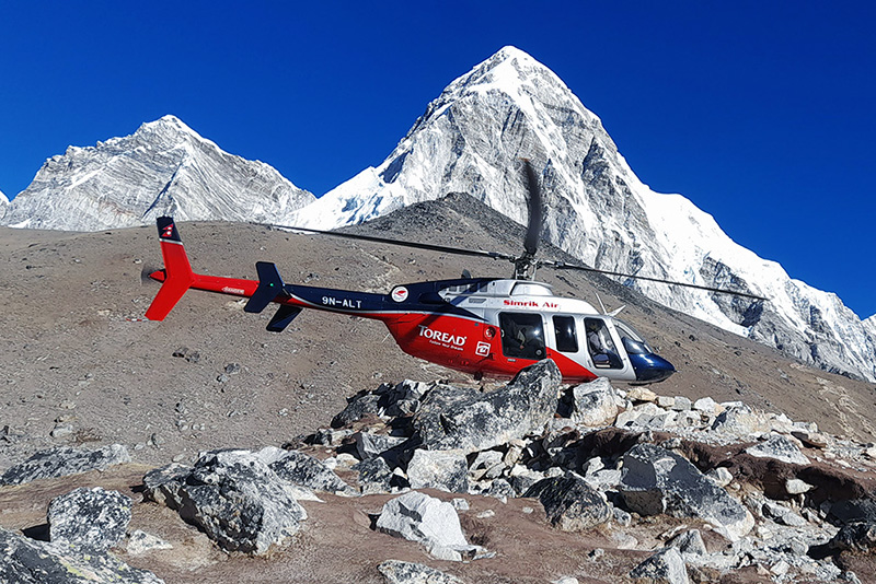
Everest Base Camp Helicopter Tour
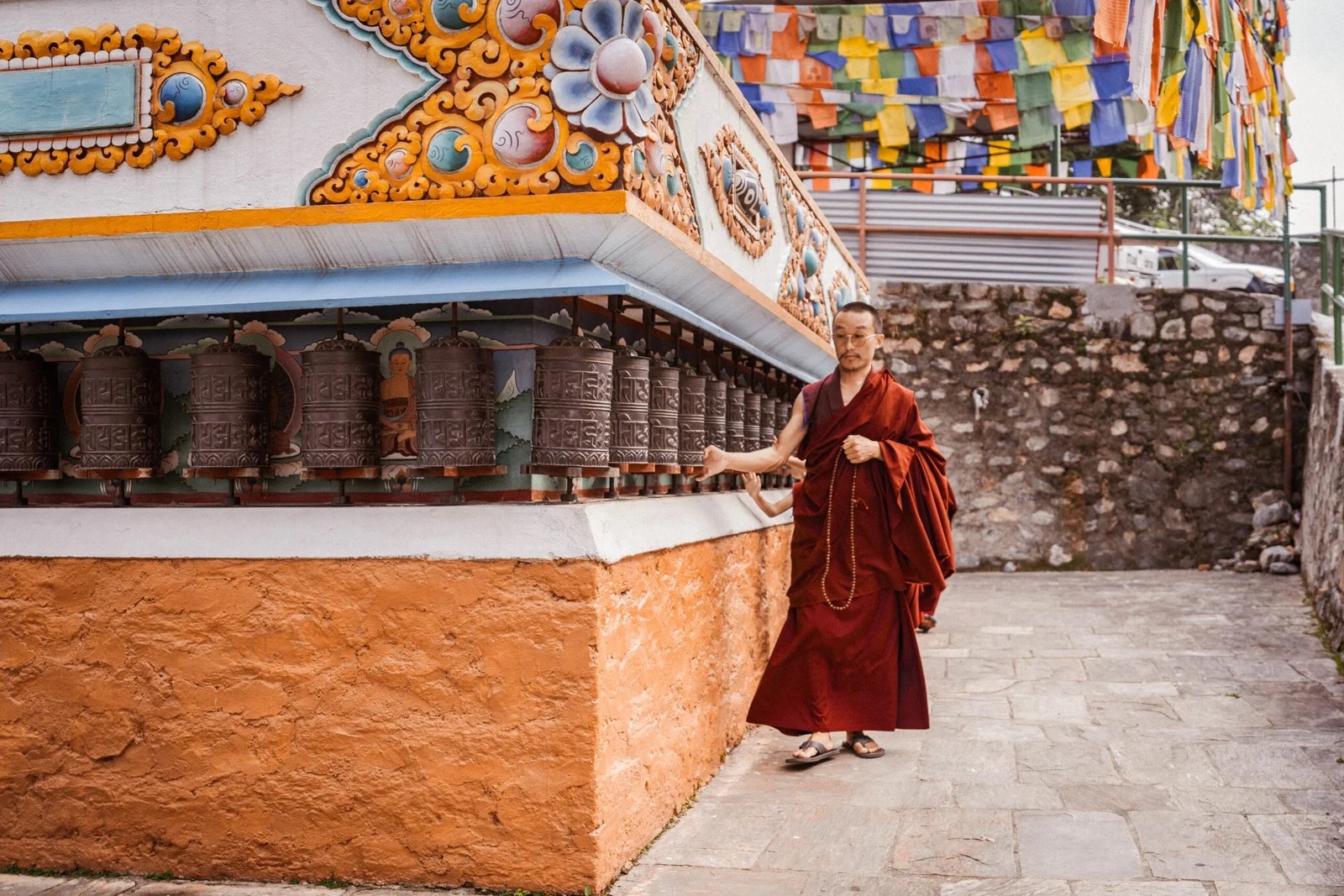
Monastery Stay Tour